Fall 2018 eNewsletter
Featured Research
Forecasting Flood Events for the Lake Champlain-Richelieu River Basin
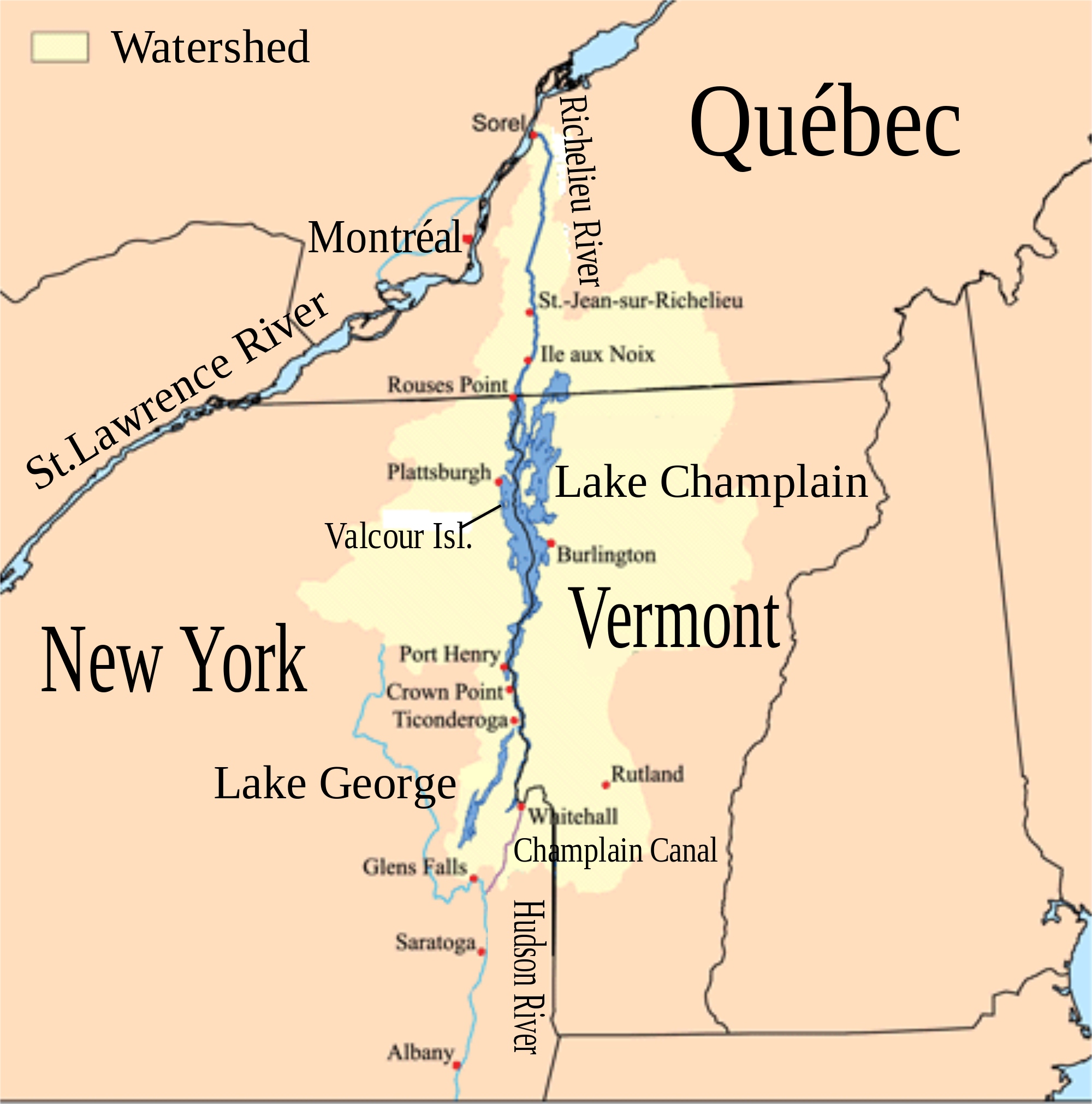
Lake Champlain, the Richelieu River, and the surrounding watershed (highlighted in light yellow).
Scientists from the Cooperative Institute for Great Lakes Research (CIGLR) and the NOAA Great Lakes Environmental Research Laboratory (NOAA GLERL) are branching outside of the Great Lakes to help a flood-prone region better prepare for the destructive effects of floods. In collaboration with the International Joint Commission, they are studying the effects of recurring floods in the Lake Champlain Basin and are working in a multi-year project to develop a real-time flood forecast modeling system. Lake Champlain is a binational lake bordered by the states of Vermont and New York and the Canadian province of Quebec. The lake connects naturally to the St. Lawrence River via Quebec’s Richelieu River and to the Great Lakes via the New York State Canal System.
The Lake Champlain basin extends along steep mountains and narrow valleys and has a relatively wet climate. In recent years, severe floods caused by intense rain events and spring snow melt have caused significant destruction of property and infrastructure in the Lake Champlain Basin. In addition, high lake water levels provided conditions for more shoreline destruction by wind waves and storm surges.
“Our team began work with the International Joint Commission in response to an intense 2011 flood in the Lake Champlain and Richelieu River Basin,” says CIGLR Research Scientist, Dr. Dmitry Beletsky. GLERL Director Deborah Lee is a member of the Lake Champlain – Richelieu River Study Board.
During the 2011 flood event, water levels increased in the basin due to a record snowfall in the area followed by intense spring rains. Records indicate that Lake Champlain stayed at flood stage for more than 65 days, affected over 3,000 homes, and caused over $6 million of damage. Having led research in this region before, Dr. Beletsky is familiar with the Lake Champlain Basin and is involved in helping the research team further develop a flood forecast model.

The Lake Champlain Project team. Pictured from left to right: Dr. Eric Anderson (NOAA GLERL), Timothy Hunter (NOAA GLERL), Dr. Chuliang (Andy) Xiao (CIGLR), Dr. Jesse Feyen (NOAA GLERL), Dr. Dmitry Beletsky (CIGLR), Dr. Philip Chu (NOAA GLERL), Lacey Mason (NOAA GLERL), and Haoguo Hu (CIGLR). Photo Credit: El Lower.
“Our goal is to use the information we gather to analyze the causes and impacts of flooding in the basin and to develop models to provide short-term (5-7 days) flood forecasts,” says Beletsky.
The scientists will design models to inform operational flood forecasts for the National Weather Service. This modeling system is being developed and implemented in a manner similar to NOAA’s Great Lakes Operational Forecast System. It will feature a watershed model providing inflows for the lake model and give information on the present and future states of the hydrological, hydrodynamic and meteorological parameters within the Lake Champlain basin (e.g. runoff, water level, circulation, temperature, and waves). The system will also support other forecast needs such as recreational activities, search and rescue efforts, and emergency management.
“It is important for the citizens of the Lake Champlain basin to be aware and informed of the water levels and flood risks in their area,” says Dr. Beletsky. “By developing a flood forecast model for this region, the residents will have more insight and preparation time for events like those of 2011.”
In future model phases, a demonstration of the hydrodynamic forecast system will be implemented by NOAA GLERL with output made available in real-time on the web, allowing academic and other researchers to access the forecast system data for use in their own research initiatives.
About the Project
The research team includes scientists with expertise in physical limnology, hydrologic, hydrodynamic, and atmospheric modeling from CIGLR (Dmitry Beletsky, Haoguo Hu, Chuliang Xiao) and NOAA GLERL (Jesse Feyen, Eric Anderson, Philip Chu, Andrew Gronewold, Deborah Lee, Lacey Mason). Funding for this research is supported by the International Joint Commission (IJC) through a NOAA award to CIGLR (NA17OAR4320152).
Related Resources
McCormick, M.J., T.O. Manley, D. Beletsky, A.J. Foley, and G.L. Fahnenstiel. 2008. Tracking the surface flow in Lake Champlain. Journal of Great Lakes Research. 34:721-730. (DOI:10.1016/S0380-1330(08)71613-7).