Invasive Species
Larval Dispersal, Habitat Classification,and Food Web Modeling
Overview and Objectives
Invasive species are one of five key NOAA-identified stressors of native biodiversity and ecosystem function in the Laurentian Great lakes. In the context of on-going management and policy discussions, it is thus critical to forecast species invasions and their costs, and to predict the effectiveness and costs of potential management responses to these invasions. By integrating ecology and economics at a landscape scale, we are working to communicate forecasts in terms of introduction pathways, which are the most appropriate targets for cost effective management, especially where preventing new invasions is the goal. We are thus using ecological models and GIS databases to support a NOAA CSCOR project (D. Lodge, PI) titled “Forecasting spread and bioeconomic impacts of aquatic invasive species from multiple pathways to improve management and policy in the Great Lakes.” To forecast what portions of the Great lakes are most vulnerable to invasions, we are using abiotic data layers to develop an environmental classification that groups areas of environmental similarity as a surrogate descriptor of biotic patterns, because abiotic data are available with more extensive spatial coverage than biological data. All GIS variables and classifications will be freely available as an output of the project and will provide a new spatial framework for a variety of applications of management interest. Products will include: maps and predictions of invasive species larval dispersal in four of five Great Lakes; developed databases and eco-regional habitat classifications for environmental niche modeling; Ecopath/Ecosim food web models and predictions of invasive species impacts on Great Lakes food webs and fisheries.
Specific objectives include:
1. Inventory, map and classify physical and biological habitat data for Great Lakes aquatic ecoregions.
2. Construct food web models for inshore and offshore waters of Lake Michigan, Lake Huron and Lake Erie.
3. Simulate bioeconomic impacts of invasive species on Great Lakes food webs.
4. Model and map natural dispersal of invasive species in Lakes Michigan, Huron, Erie and Ontario.
Publications
Zhang, H., Rutherford, E, Mason D. M., Breck, J., Cooke, R., Wittmann, M., Johnson, T., Zhu, X., Lodge, D. 2016. Forecasting the Impacts of Silver and Bighead Carp on the Lake Erie Food Web. Transactions of the American Fisheries Society 145(1):136-162.
Kao, Y-C., Adlerstein, S., and Rutherford, E. S. 2016. Assessment of bottom-up and top-down controls on the collapse of alewives Alosa pseudoharengus in Lake Huron. Ecosystems.
Wang, L., C. M. Riseng, L. A. Mason, K .E. Wehrly, E. S. Rutherford, J. E. McKenna, Jr., C. Castiglione, L. B. Johnson, D. Infante, S. E. Sowa, M. Robertson, J. Schaeffer, M. Khoury, J. Gaiot, T. Hollenhorst, C. Brooks, and M. Coscarelli. 2015. A Hierarchical Spatial Classification and Database for Management, Research, and Policy Making: the Great Lakes Aquatic Habitat Framework Journal of Great Lakes Research. Journal of Great Lakes Research 41: 584–596.
Beletsky D. , R. Beletsky, E. S. Rutherford , J.L. Sieracki, J. M. Bossenbroek, W. L. Chadderton, M. E. Wittmann, G. Annis and D. Lodge. 2016. Spread of aquatic invasive species by lake currents. J. Great Lakes Res. (in revision).
Tucker, A.J, W. L. Chadderton, C. L. Jerde, M. A. Renshaw, K. Uy, C. Gantz, A. R. Mahon, A. Bowen, T. Strakosh, J. M. Bossenbroek, J. L. Sieracki, D. Beletsky, J. Bergner, and D. M. Lodge. 2016. A sensitive environmental DNA (eDNA) assay leads to new insights on Ruffe (Gymnocephalus cernua) spread in North America. Biological Invasions (accepted)
Kramer, Annis, Wittmann, Chadderton, Rutherford, Lodge, Mason, Beletsky, Riseng, 2016. Suitability of Great Lakes for aquatic invasive species based on global species distribution models and local aquatic habitat. Ecological Applications (in revision)
D. M. Lodge, P.W. Simonin, S. W. Burgiel, R. P. Keller, J. M. Bossenbroek, C. L. Jerde, A. M. Kramer, E. S. Rutherford, M. A. Barnes, M. E. Wittmann, W. L. Chadderton, J. L. Apriesnig, D. Beletsky, R. M. Cooke, J. M. Drake, S. P. Egan, D. C. Finnoff, C. A. Gantz, E. K. Grey, M. H. Hoff, J. G. Howeth, R. A. Jensen, E. R. Larson, N. E. Mandrak, D. M. Mason, F. A. Martinez, T. J. Newcomb, J. D. Rothlisberger, A. J. Tucker, T. W. Warziniack, and H. Zhang, 2016. Risk analysis and bioeconomics of invasive species to inform policy and management. Annual Review (accepted)
Wittman, M. E., G. Annis, A.M. Kramer, L. Mason, C. Riseng, E. S. Rutherford, W. L. Chadderton, D. Beletsky, J. M. Drake, D. M. Lodge. 2016. Refining species distribution model outputs using landscape scale habitat data: Forecasting Grass Carp and Hydrilla verticillata establishment in the Great Lakes Region. J. Great Lakes Res (in revision)
Presentations
Ivan, L., *Rutherford, E., Mason, D., Zhang, H., Hunter, T., Hoff, M. An Individual-based bioenergetics model forecast of Silver and Bighead Carp establishment likelihood and impact in Saginaw Bay, Lake Huron and Lake Erie. The 2nd Mississippi-Yangtze River Basins Symposium (MYRIBS) & the 2015 China Society of Fisheries Resources and Environment Annual Meeting. Wuhan, China, Oct 12-17, 2015.
PrincipaI Investigator(s):
Dmitry Beletsky (CILER)
NOAA Technical Lead(s):
Ed Rutherford (NOAA-GLERL)
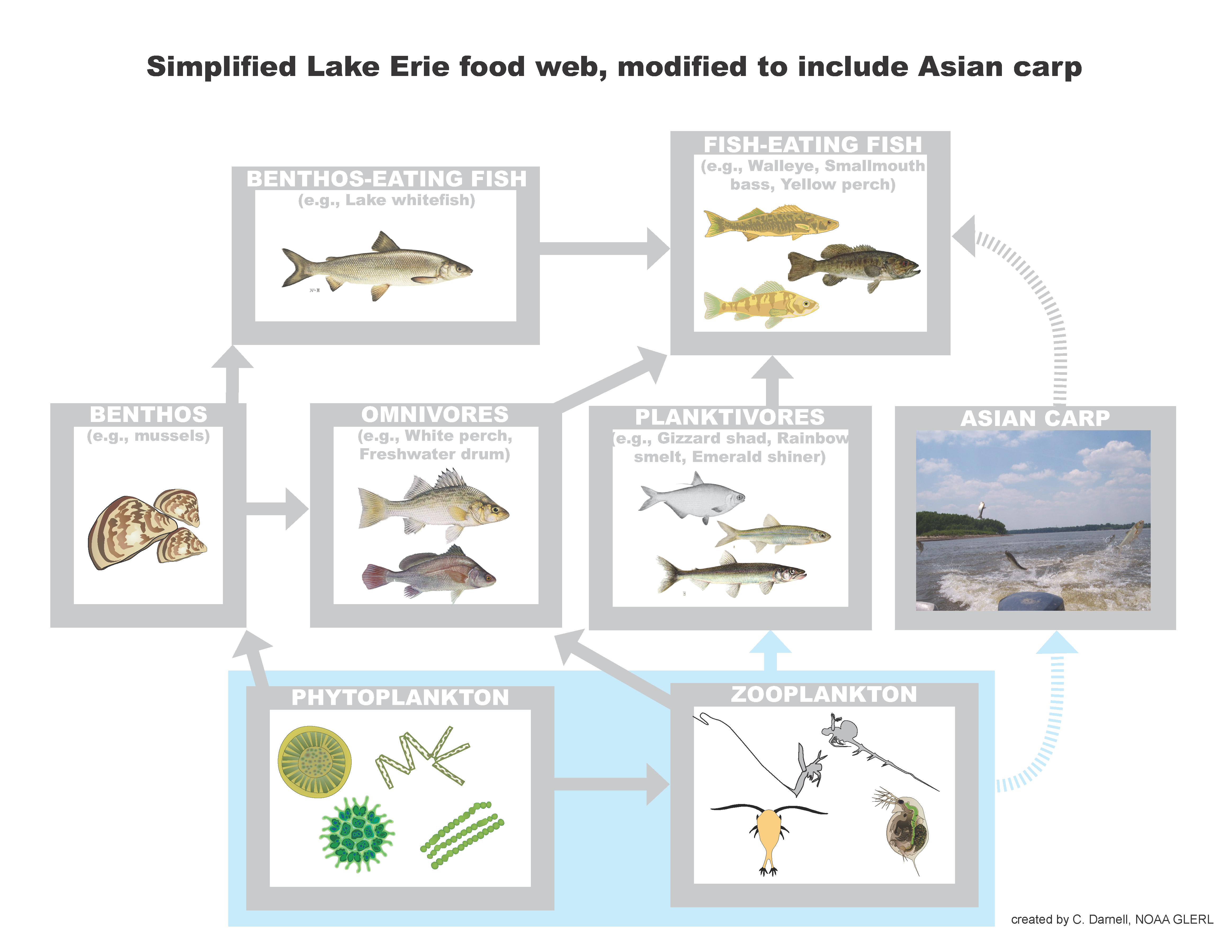
Simplified Lake Erie food web, modified to include invasive Carp. Invasive carp could affect the Lake Erie food web in two ways: by competing with native fish by eating their food and becoming food for other predatory fish. Graphic Credit: Hongyan Zhang, CIGLR Research Scientist.
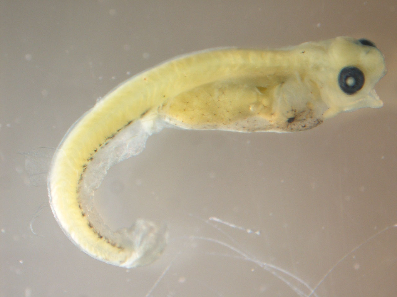
Fish larvae, walleye.

Silver Carp. Credit: D. O’Keefe, Michigan Sea Grant
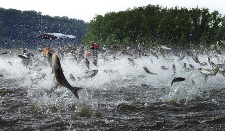
When frightened, Bighead and Silver varieties of invasive carp can jump up to 10 feet out of the water. Photo Credit: AP Photo/Illinois River Biological Station via the Detroit free Press, Nerissa Michaels.