Clayton Kingdon
Modeling Data Analyst
4840 South State Street
Ann Arbor, MI 48108-9719
Photo Gallery
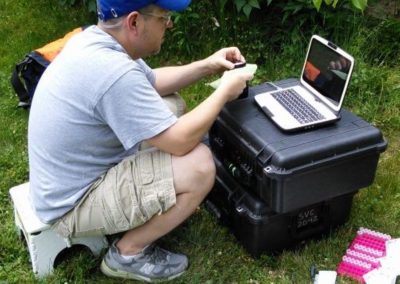
Clayton Kingdon, a researcher in the Townsend lab at UW-Madison and FAA-licensed UAV pilot, is encouraged to have the new policy in place. Kingdon did test flights at UW’s Arlington Agricultural Research Station. Photo Credit: UW-Madison.
I work with the Ecosystem Dynamics branch, as part of the Coordinated Science Monitoring Initiative with Mike Fraker, Mark Rowe, and Peter Alsip, where I use programming tools to analyze data and evaluate hydrodynamic and biogeochemical model performance. I’ve spent most of my career working in grant-funded research labs, previously at the University of Wisconsin and University of Maryland. Prior to joining CIGLR, my work focused on the use of remote sensing technologies (specifically, multi- and hyper-spectral airborne and satellite imagery) along with portable and UAV-mounted spectrometers, to map nutrient content of vegetation, do pre-visual detection of disease, and assess the health and productivity of vegetation in forest and agricultural ecosystems. Broadly, I am interested in novel uses of geospatial technologies, quantitative methods, and in-situ data for measuring, monitoring, and understanding the natural world.
Education:
- A.D. Remote Sensing, Nova Scotia College of Geographic Sciences, 1997
- B.S. Geology, Carleton University, 1995
Research Interests/Area of Expertise:
-
quantitative methods and statistical analysis
-
remote sensing & geospatial technologies
-
ecological modeling
Selected Publications:
Cavender-Bares, J., Meireles, J.E., Couture, J.J., Kaproth, M.A., Kingdon, C.C., Singh, A., Serbin, S.P., Center, A., Zuniga, E., Pilz, G. and Townsend, P.A. 2016. Associations of Leaf Spectra with Genetic and Phylogenetic Variation in Oaks: Prospects for Remote Detection of Biodiversity. Remote Sensing. 8:221–238. (DOI:10.3390/
Singh, A., Serbin, S.P., McNeil, B.E., Kingdon, C.C. and Townsend, P.A. 2015. Imaging spectroscopy algorithms for mapping canopy foliar chemical and morphological traits and their uncertainties. Ecological Applications. 25:2180–2197. (DOI:10.1890/14-
Serbin, S.P., Singh, A., Desai, A.R., Dubois, S.G., Jablonski, A.D., Kingdon, C.C., Kruger, E.L. and Townsend, P.A. 2015. Remotely estimating photosynthetic capacity, and its response to temperature, in vegetation canopies using imaging spectroscopy. Remote Sens. Environ. Special Issue on the Hyperspectral Infrared Imager (HyspIRI). 167:78–87. (DOI:10.1016/j.rse.
Madritch, M.D., Kingdon, C.C., Singh, A., Mock, K.E., Lindroth, R.L. and Townsend, P.A. 2014. Imaging spectroscopy links aspen genotype with below-ground processes at landscape scales. Phil. Trans. R. Soc. B. 369:20130194. (DOI:10.1098/rstb.
Townsend, P.A., Singh, A., Foster, J.R., Rehberg, N.J., Kingdon, C.C., Eshleman, K.N. and Seagle, S.W. 2012. A general Landsat model to predict canopy defoliation in broadleaf deciduous forests. Remote Sens. Environ. 119:255–265. (DOI:10.1016/j.rse.
Townsend, P.A., Helmers, D.P., Kingdon, C.C., McNeil, B.E., de Beurs, K.M. and Eshleman, K.N. 2009. Changes in the extent of surface mining and reclamation in the Central Appalachians detected using a 1976–2006 Landsat time series. Remote Sens. Environ. 113, 62–72. (DOI:10.1016/j.rse.
Townsend, P.A., Lookingbill, T.R., Kingdon, C.C. and Gardner, R.H. 2009. Spatial pattern analysis for monitoring protected areas. Remote Sens. Environ. 113:1410–1420. (DOI:10.1016/j.rse.
Wolter, P.T., Townsend, P.A., Sturtevant, B.R. and Kingdon, C.C. 2008. Remote sensing of the distribution and abundance of host species for spruce budworm in Northern Minnesota and Ontario. Remote Sens. Environ. 112:3971–3982. (DOI:10.1016/j.rse.


