Protection & Restoration of Ecosystem Services
2015 Synthesis, Observations, and Response (SOAR)
Overview
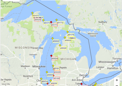
The implementation of the Great lakes Synthesis, Observations and Response System program (SOAR) is designed to coordinate and integrate regional coastal observations that support national and regional priorities, including Great Lakes restoration. SOAR activities include the deployment and support of on-water and remote sensing platforms. Observations from these systems are used to create database products for assessment and decision support, providing an up-to-date (including real-time data) web data presence. The overall objective of the SOAR project is to provide real-time ecosystem information to maintain high quality drinking water and bathing beaches through observations, data management, and forecast model development. Observations of environmental parameters are used to develop decision support tools to provide warnings to regional managers regarding phosphorous loads, hypoxia and harmful algal blooms, and to support adaptive management process decisions. These decision support tools include: real-time observing system components (buoys) deployed at Maumee Bay (Lake Erie), Saginaw Bay (Lake Huron), Muskegon Lake Area of Concern (AOC), Lake Michigan, and Lake Erie; a web-based data management system; synthesized remote sensing products for predicting harmful algal blooms (HABs); and coupled physical-chemical-biological models for Green Bay (Lake Michigan), Saginaw Bay (Lake Huron), and western Lake Erie. Instrumentation deployed in and near AOCs will provide observations of hypoxia and soluble reactive phosphorous, and support detection of HABs. Specific components of these research activities are led by CILER Partners at Michigan Tech Research Institute (MTRI) and Grand Valley State University (GVSU) as defined below.
MTRI has worked together with NOAA GLERL and CILER over the last decade on the development of satellite-based algorithms that specifically address water quality issues in the Great Lakes. An important component of this work is the measurement of backscatter and absorption coefficients of nearshore and offshore waters in all five Great Lakes. Accurate backscatter and absorption coefficients are necessary inputs into Great Lakes satellite-based algorithms that provide chlorophyll, dissolved organic carbon (DOC), colored dissolved organic matter (CDOM), total suspended matter (TSM), HABs, water clarity, and photic zone estimates. Previous in situ optical property measurements collected by NOAA GLERL, MTRI, and the Upstate Freshwater Institute (UFI) are located in the Great Lakes Optical Properties Geospatial Database (GLOPGD) which can be found on line at http://glopgd.org/. This collaborative effort between GLERL and MTRI addresses collection of additional in situ optical properties during the 2015 field season.
Field sites include: 1) 3-4 sites off the NOAA Lake Michigan Field Station, 2) 4-5 stations in the western basin of Lake Erie, and 3) multiple sites in Lake Superior during a single late summer cruise. The Muskegon and Lake Erie sites were repeatedly measured at a minimum of a monthly interval, with weekly and bi-weekly intervals used during times when the biota and sediment are rapidly changing.
GVSU continued to operate the Muskegon Lake Observatory (MLO) buoy, which was initially developed under funding from EPA’s GLRI program (2011-2014). The current project continues to build much-needed long-term time series data for this Great Lakes AOC, and enable making new scientific discoveries such as detection of hypoxia and CyanoHABs with management implications. The MLO project utilizes GVSU Annis Water Resources Institute (AWRI) and NOAA GLERL resources, building a key regional infrastructure that supports students, scientists, resource managers, and policy makers.
I. Development of Decision Support Tools (PI: Dr. Thomas Johengen, CILER)
• Provide real-time, quality assured, phosphorous and optical data for the web-based decision support system in development
• Provide data for satellite ground-truth and to contribute to forecast information to beach and water intake managers
• Better understand the causes of nutrient-related nearshore biological impairments and contribute the necessary environmental data to assess the effectiveness of watershed remedial actions
• Develop predictive modeling methods to improve the accuracy of decisions for water intake and beach managers to better protect public health
• Incorporate improved remotely-sensed estimations, including airborne hyperspectral observations, into daily forecasts for use in decision support tools and for adaptive management
• Better understand the interaction of internal waves and upwelling on the entrainment of hypoxic water into locations of water intakes
II. Optical Property Measurements of Great Lakes Water (PIs: Dr. Robert Shuchman and Mr. Mike Sayers, Michigan Tech Research Institute)
• Generate updated IOP data to further refine CPA-A HO Model performance
• Observe seasonal and spatial changes in IOPs due to shifts in phytoplankton composition
• Quantify nearshore and offshore IOP gradients
• In Lake Erie determine HO model parameters for two dominating sediment types (calcite and red clay), and
• Generate HABs-specific HO models for more robust HABs satellite retrievals.
III. Observatory for Ecosystem Changes in Muskegon Lake AOC (2015-16) (PI: Bopiah Biddanda, Grand Valley State University, Annis Water Resources Institute)
The primary objectives of the project are to operate and maintain the Muskegon Lake Observatory (MLO) buoy, conduct collaborative research with time-series data, and contribute to limnological education and outreach. Since 2011, the MLO has been operated in Muskegon Lake, Muskegon, MI, and is equipped with meteorological and water quality sensors from lake surface to bottom. A dedicated website for the project is maintained at www.gvsu.edu/buoy/ where current and historical data are accessible to researchers and the public. Select data feeds into the Integrated Ocean Observing System (IOOS) through the Great Lakes Observing System portal at http://glos.us/.
Publications
Defore, A. D., A. Weinke, M. Lindback, and B. Biddanda (In Press, Aquatic Microbial Ecology, 2016): Year-round Measures of Planktonic Metabolism Reveal Net Autotrophy in Surface Waters of a Great Lakes Estuary
Dila, D. K. and B. A. Biddanda (2015): From land to lake: Contrasting microbial processes across a Great Lakes gradient of carbon and nutrient inventories. J. Great Lakes Res 41:75-85.
Fahnenstiel, G., M. Sayers, R.A. Shuchman, F. Yousef, and S. Pothoven. “Lake-wide phytoplankton production and abundance in the Upper Great Lakes: 2010–2013.” Journal of Great Lakes Research. 42, no. 3 (2016): 619-629 doi: 10.1016/j.jglr.2016.02.004
McNair, J.N., Sesselmann, M.R., Gereaux, L.C., Weinke, A.D., Kendall, S.T., and Biddanda, B.A. (2015): Alternative approaches for estimating components of lake metabolism using free-water dissolved-oxygen method. Fundamental Applied Limnology 186: 21-24
Sayers M., G.L. Fahnenstiel, R.A. Shuchman, and M. Whitley. “Cyanobacteria blooms in three eutrophic basins of the Great Lakes: a comparative analysis using satellite remote sensing.” International Journal of Remote Sensing 37, no. 17 (2016): 4148-4171. DOI: 10.1080/01431161.2016.1207265
Vail, J., A. Meyer, A. Weinke and B. Biddanda (2015): Water quality monitoring: Lesson plan for exploring time-series data. J. Michigan Teachers Association 6: 37-48.
Presentations
Ruberg, S., G. Leshkevich, A. Vander Woude, D. Stuart, M. Sayers, R. Shuchman, A. Grimm, and K. Bosse. “Inherent and Apparent Optical Property Observations and Trends in Western Lake Erie for 2015.” IAGLR 59th Annual Conference on Great Lakes Research June 6-10(2016).
Brooks, C.N., R.A. Shuchman, M. Sayers, A.G. Grimm, M.G. Billmire, and R. Sawtell. “Sharing Great Lakes remote sensing data through integrated web portals.” IAGLR 59th Annual Conference on Great Lakes Research June 6-10(2016).
Koopmans, D., A. Weinke, S. Kendall, J. V. Klump, and B. Biddanda (October 9, 2015): Can Upwelling Along Lake Michigan’s Eastern Shore Ameliorate Hypoxia in Drowned River Mouth Lakes? A Case Study in Muskegon Lake. State of Michigan Water Collaboration Workshop, Roscommon, MI (Poster).
Doster, M, A. Weinke, D. Koopmans and B. Biddanda (November 21, 2015). Analyzing drivers of and linkages between hypoxia and algal blooms in a Great lakes Estuary using time series observations. West Michigan Undergraduate Research Conference (Poster)
Vail, J., D. Koopmans and F. Januska (November 18, 2015). Water Quality Monitoring: Exploring Time-Series Data”. Fall science Update to STEM teachers, Regional Math and Science Center, GVSU, Allendale, MI (Oral).
Biddanda, B., D. Koopmans, A. Weinke and J. Vail (November 19, 2015). Using observatory data to understand ongoing ecosystem changes in Muskegon Lake. Presentation to students of AP Environmental Science class from North Muskegon High School (Oral).
Weinke A., C. Ruetz., D. Koopmans and B. Biddanda (January 26, 2016). Out of Breath: Hypoxia and Its Effects On Fish Species Composition and Abundance In The Bottom Waters of Muskegon Lake, Michigan, With Lake-Wide Implications. West Michigan Fish and Wildlife Conference, Grand Rapids, MI (Poster).
Weinke, A. and B. Biddanda (February 24, 2016): Layered lake: Ecosystem dynamics in a freshwater estuary during the growing season with respect to climate change, stratification, and episodic mixing events. Association for Sciences of Limnology and Oceanography Ocean Science Conference, New Orleans, LA (Poster).
Biddanda, B. (March 12, 2016): Muskegon Lake Observatory: What it means to boaters and public. Spring Thaw Open House Event at Torresen Marine, Muskegon Michigan (Oral).
Weinke, A., D. Koopmans, S. Kendall and B. Biddanda (June 9, 2016): “Time –series buoy observatory allows monitoring of difficult to track unforeseen episodic lake phenomena”. IAGLR, 59th Annual Conference of the International Association for Great Lakes Research. Guelph (Oral).
STUART, D.G. , PALLADINO, D. , JOHENGEN, T.H. , RUBERG, S.A. , PURCELL, H.L. , MILLER, R.J. , ANDERSON, E.J. , VANDER WOUDE, A.J. , BURTNER, A. , SMITH, J.P. , and DAVIS, T.W. Improvements in Monitoring and Prediction of Western Lake Erie Harmful Algal Blooms. 59th Annual Conference on Great Lakes Research. Guelph, Ontario. June 6-10, 2016.
MILLER, R.J., JOHENGEN, T.H., VANDERPLOEG, H.A., HOFFMAN, J., HOLLENHORST, T., FIORENTINA, L.A., and AUSTIN, J.A. Application of Underwater Gliders to Map Nearshore-Offshore Gradients During 2015 Lake Michigan CSMI. 59th Annual Conference on Great Lakes Research. Guelph, Ontario. June 6-10, 2016.
VANDER WOUDE, A.J., STUART, D.G., RUBERG, S.A., JOHENGEN, T.H., MCCARTY, B., CHURNSIDE, J.H., PALLADINO, D., and BURTNER, A. Chlorophyll a and Phycocyanin from Hyperspectral Airborne and Hand-held Sensors on Lake Erie. 59th Annual Conference on Great Lakes Research. Guelph, Ontario. June 6-10, 2016.
Palladino, D., Johengen, T.H., Ruberg, S.A., Miller, R.J., Purcell, H.L., Stuart, D.G., and Burtner, A.B. A Retrospective Look at Algal Blooms in Western Lake Erie using High Frequency Real-time Monitoring Network. American Society for Limnology and Oceanography Summer Meeting, Santa Fe, NM. June 5-10, 2016.
Johengen, T.H., Palladino, D., Miller, R.J., Stuart, D.G., Purcell, H.L., Ruberg, S.A. Continuous Water Quality Monitoring to Understand Drivers of Harmful Algal Blooms in Lake Erie. American Society for Limnology and Oceanography Summer Meeting, Santa Fe, NM. June 5-10, 2016.
Miller, R.J., Johengen, T.H., and Ruberg, S.A. Lake Erie Nutrient and Harmful Algal Bloom Monitoring Buoys. 2016 NOAA Buoy Workshop, Woods Hole Oceanographic Institute. Boston, MA.
Products
PrincipaI Investigator(s):
Tom Johengen (CILER)
Bob Shuchman (MTRI)
Boppaiah Biddanda (GVSU)
NOAA Technical Lead(s):
Steve Ruberg (NOAA-GLERL)
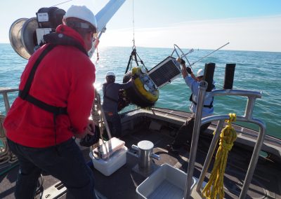
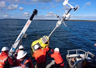
Russ Miller and Tom Johengen servicing one of the four western Lake Erie real-time water quality monitoring buoys.
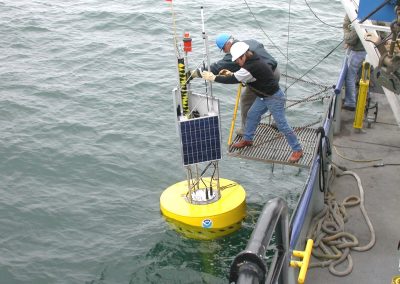
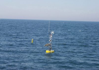
GLERL portable observatory buoy. Datalink buoy deployment, October 3, 2002. Lake Michigan. S. Ruberg and D. Donahue. http://www.glerl.noaa.gov/obs
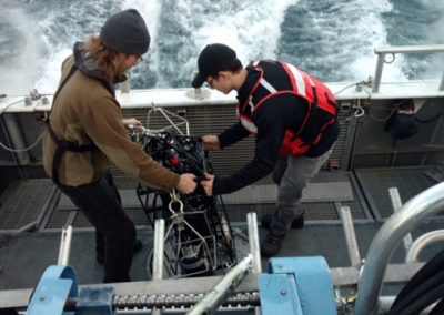
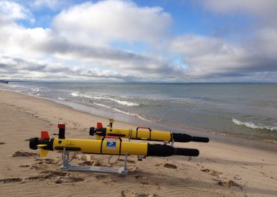
Testing Autonomous Underwater Vehicles (AUVs) in Lake Michigan near Muskegon for mussel mapping. The vehicles were deployed along the Muskegon long-term research transect and they safely returned. September 30, 2014. Credit: NOAA
Buoy in western Lake Erie for harmful algal bloom monitoring and research, July 29, 2015. Credit: NOAA

