Summer 2018 eNewsletter
CIGLR Spotlight
Postdoctoral Research Fellowship Update
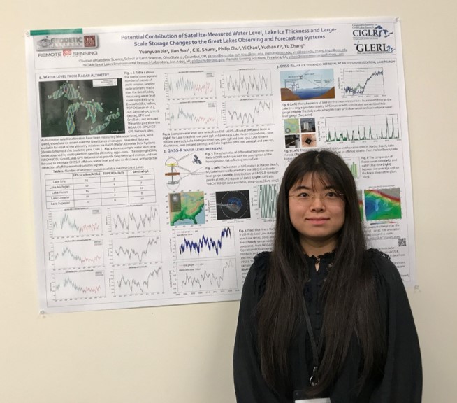
Dr. Yuanyuan Jia presents her poster about how satellites can improve Great Lakes water level and lake ice thickness observations and forecasts at the 2017 CIGLR Annual Partners Meeting. Photo Credit: Michele Wensman.
Using Satellite Data to Improve Great Lakes Monitoring and Forecasting
Dr. Yuanyuan Jia, Ohio State University
Dr. Yuanyuan Jia is a CIGLR postdoctoral research fellow at the Ohio State University working with Drs. C.K. Shum (OSU) and Philip Chu (NOAA GLERL). During the first year of her fellowship, Dr. Jia has collected and processed satellite data, specifically from radar altimetry, for Lakes Erie, Michigan, Huron, Ontario and Superior. Radar altimetry is a remote sensing technique that uses satellites to bounce thousands of radar pulses per second off Earth’s surface, providing contours, shapes and other useful environmental mapping information (Figure 1). The satellite data she is using span more than three decades (1985-2018) and are being used to complement existing data sets from NOAA’s CoastWatch program and NOAA GLERL’s Observing Systems and Advanced Technology (OSAT) research branch. Her work will expand the use of near real-time satellite data and provide more detailed information on Great Lakes water levels, wave heights, wind speed, lake ice, water color, and potentially meteotsunami signals, ultimately supporting improved forecasts of these factors.
Historical and current radar altimetry data for the Great Lakes give scientists a window to the changes in water levels and other important environmental variables through time. These data can be used to improve forecasts of water availability, flood and drought events, and overall climate change. Yuanyuan’s preliminary research results on the accuracy of radar altimetry data are encouraging. Her comparisons between monthly water level data from in situ gauges and satellite radar altimetry data for Lake Superior are in close agreement (R^2 ~0.98) (Figure 2) and the data quality from the different satellite missions was very accurate.
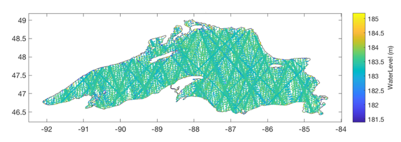
Figure 1: Radar altimetry tracks over Lake Superior from 1985-2018, color coded by water levels across the lake in meters. The x-axis describes longitude, the y-axis describes latitude.
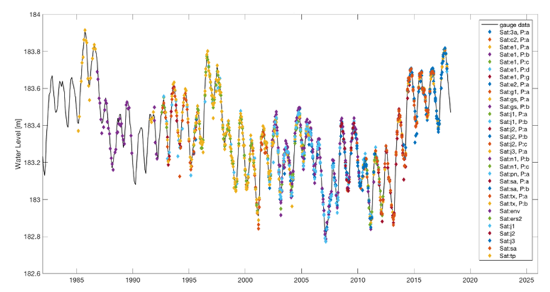
Figure 2: Comparison of monthly lake-wide average water level gauge data (solid line) and satellite radar altimetry data (color-coded by satellite) for Lake Superior, 1985-2018. The x-axis describes the year and the y-axis describes the water level in meters, recorded by the different multi-mission satellites.
Yuanyaun’s next steps are to use multi-mission satellite radar altimetry to generate 3D water level time series and other environmental tools, with the goal of improving near real-time Great Lakes monitoring and forecasting.
Dr. Yuanyuan Jia was awarded a two-year postdoctoral fellowship by CIGLR and is completing her research at the Ohio State University (OSU) School of Earth Sciences, working with C.K. Shum at OSU and Philip Chu at NOAA GLERL. During her two-year fellowship, she is investigating the use of satellite data to complement the Great Lakes Observing System (GLOS) and improve the forecast reliability of the Great Lakes Operational Forecasting System (GLOFS). Yuanyuan received her M.S. and Ph.D. degrees in Geodetic Sciences from the Ohio State University.