Summer 2023 eNewsletter
Extreme Water Level Effects on Great Lakes Coastal Wetlands
Great Lakes coastal wetlands (hereafter “coastal wetlands”) support numerous ecosystem services, from providing clean water and recreational opportunities to protecting shorelines from storms and flooding. Despite their importance, human actions continue to threaten the existence of coastal wetlands. Shoreline hardening (e.g., shoreline development, seawalls, riprap shorelines, etc.) disconnects wetlands from the landscape, halting flow of aquatic life, water, and sediment, and ultimately preventing wetlands from adapting to changing water levels. Coastal wetlands can naturally adjust to increases in water levels through vertical migration (horizontal build-up of sediment and organic matter) and horizontal migration (lakeward or landward spread of vegetation). However, climate change compounds the issue of hardened shorelines by altering water level dynamics, where water levels may shift faster than coastal wetlands can adapt.

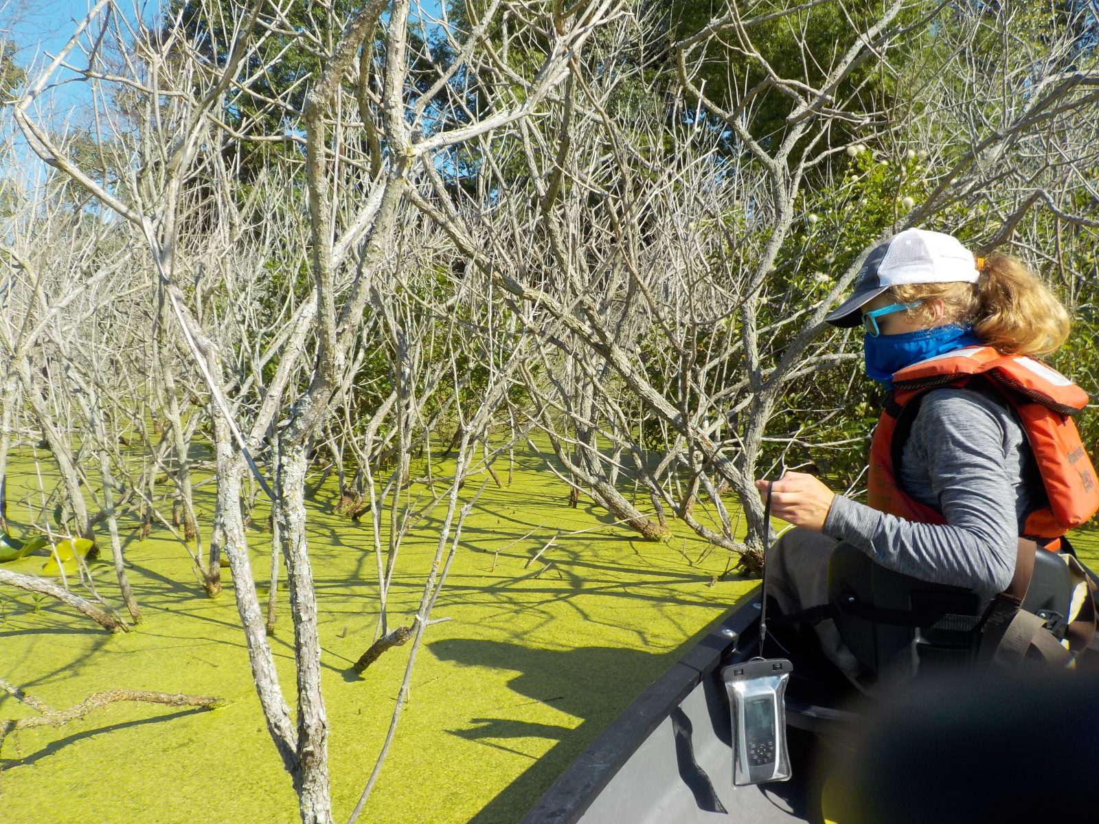
Olivia Anderson collecting wetland field samples during her research at Central Michigan University.
Recent decades saw unprecedented (for recorded history) dynamics in Great Lakes water levels: 2000–2015 experienced an extended low-water level period, which was followed by record highs in 2017–2020. The Great Lakes Coastal Wetland Monitoring Program (GLCWMP) has a growing database of coastal wetland vegetation surveys, which began in 2011. Former CIGLR graduate fellow Olivia Anderson and colleagues used these data to investigate how coastal wetlands extent (i.e., wetland length perpendicular to the shoreline) changed with the extreme increase in water levels from 2011–2019, using data from 342 sites across all five Great Lakes.
“Based on our recently published findings, a majority of coastal wetlands migrated landward from 2011 to 2019, suggesting coastal wetlands were adapting to increased water levels,” said Anderson. “However, 38% of wetlands in the study did not exhibit landward migration, potentially indicating shoreline barriers to movement. Even if wetlands were able to migrate landwards, some still shrunk under increased water levels.”
Anderson’s analysis found that, generally, wetland extent decreased with increased water levels, depending on the presence of certain dominant vegetation zones, or plant communities. Coastal wetlands often consist of three primary vegetation zones:
-
- wet meadow zones, which are located nearest to land of the three zones and primarily consist of grasses and sedges, and may or may not have standing water;
- emergent zones, which are characterized by species like cattail and bulrushes, with deeper water than wet meadows; and
- submergent zones, which are characterized by floating-leaved and submerged species like lily pads and pondweeds, and always have standing water.
“Of the three vegetation zones, the largest decrease in wetland extent was associated with the wet meadow zone,” said Anderson. “Wet meadows are the most susceptible of the three zones to water level increase because wet meadow plant communities are not adapted to deeper water, unlike emergent and submergent communities.” If landward migration of the wetland is hindered, for example by hardened shorelines, wet meadows are the first zone to shrink and eventually disappear. Emergent zones are tolerant of deeper water, though not as deep as submergent zones, and can even persist for a period without standing water. Thus, the relationship between water levels and wetland extent when emergent zones are present likely depends upon the initial water level. “When water levels are low and then rise, emergent zones may expand. If water levels are already high and increase further, emergent species may drown,” said Anderson. Submergent vegetation can tolerate a wide range of water depths, thus its presence is not as closely linked to water levels as it is for wet meadow or emergent vegetation. In Anderson’s study, submergent zone presence in a wetland had little impact on how water levels influenced wetland extent.
A decrease in coastal wetlands extent is concerning because it likely relates to a decrease in wetland function and habitat.
“A better understanding of how coastal wetlands migrate with shifts in water levels enables decision makers to better predict where Great Lakes coastal wetlands are at risk of being lost and thus where to prioritize management efforts,” said Anderson. “For example, wetland areas with shoreline barriers to migration will inevitably lead to decreases in wetland extent, even if water level rise is steady enough to support wetland migration. Wetlands primarily consisting of wet meadows are especially at risk of disappearance since wet meadows are the most sensitive to extreme water level increases.”
A next step in improving understanding of how extreme water levels influence Great Lakes coastal wetlands is to pair methods and findings from Anderson’s research with data on animal communities (e.g., fish, birds) and water quality from the same wetlands using coastal wetland datasets.
“Such analyses could further examine how changes in wetland extent may impact wetland function and provision of ecosystem services, which are vital to the sustainability of the Great Lakes region,” said Anderson.
About the Author: Olivia Anderson recently graduated from Central Michigan University with a master’s degree in biology, advised by Donald Uzarski (PhD, CMU) and co-mentored by Casey Godwin (PhD, CIGLR). She was a 2020-2021 CIGLR Graduate Research Fellow recipient. Currently, Olivia is pursuing a PhD at the Swedish University for Agricultural Sciences working to develop a decision support tool to help manage ditches in forests across Sweden.
Related Articles and Resources:
-
- Anderson, O., Harrison, B. Heumann, C. Godwin, D. Uzarski. 2023. The influence of extreme water levels on coastal wetland extent across the Laurentian Great Lakes. Science of the Total Environment. 885:163755. (DOI:10.1016/j.scitotenv.2023.163755).
