
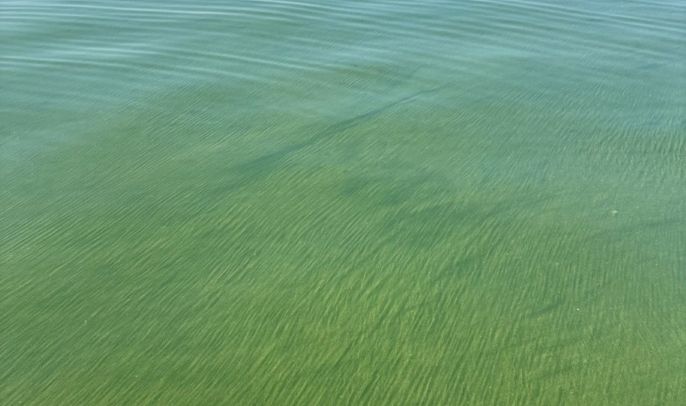
Every summer, harmful algal blooms (HABs) return to western Lake Erie. But these blooms don’t look the same every year. Their size, location, concentration, and duration can all change, making them challenging to understand and predict.
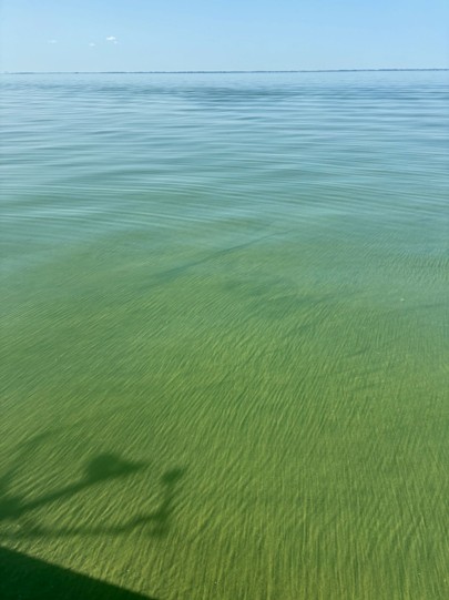
The annual harmful algal bloom in western Lake Erie as seen from the T7 sampling station during the Lake Erie Transect cruise in August 2024. Photo Credit: Jasmine Mancuso.
A new study led by researchers with the University of Michigan Cooperative Institute for Great Lakes Research (CIGLR) and NOAA Great Lakes Environmental Research Laboratory (NOAA GLERL) is helping scientists better understand one factor that may influence these differences: the interaction between two major rivers that flow into western Lake Erie, the Detroit River and the Maumee River.
The two rivers bring very different water to the lake. The Detroit River supplies about 94% of the water entering western Lake Erie, carrying cool water from the upper Great Lakes. The Maumee River contributes only about 4% of the water entering the western basin, but its flow can carry pulses of nutrients, organic material, and sediment from its largely agricultural watershed. Despite this huge difference in volume, the two rivers contribute comparable annual amounts of total phosphorus to western Lake Erie. Together, they account for roughly 90% of the western basin’s total phosphorus inputs. Where these two water sources meet, they create a dynamic transition zone that shifts and changes throughout the year. Understanding how these waters interact may help scientists better explain the environmental conditions associated with harmful algal blooms.

Jasmine Mancuso, lead author of the study and CIGLR Aquatic Ecology Research Analyst.
“We know from previous research that the Detroit River inflow to western Lake Erie is relatively steady over time, both in discharge and chemical composition, while the Maumee River is much more variable,” said CIGLR scientist Jasmine Mancuso, lead author of the study. “Although the Maumee River is widely recognized as a major contributor to western Lake Erie HAB conditions, the Detroit River supplies most of the water to the western basin. The contrast between these two inflows creates a gradient of physical and chemical conditions that allows us to study how algae respond to changing environmental conditions. Like land plants, algae are limited by light, nutrients, temperature, and predation, so there is likely a “Goldilocks zone” where conditions are ideal for growth. By sampling along a 31-kilometer transect over 6–7 months, we’re able to see how environmental and biological conditions change across space and time and ask: where and when do algae, including cyanobacteria, thrive in western Lake Erie?”
This year, NOAA and its research partners are forecasting a moderate harmful algal bloom in western Lake Erie. Most of the bloom is expected to remain in the western basin, although localized blooms can also develop near some rivers following summer rainstorms. NOAA’s seasonal forecast is based in part on phosphorus loading from the Maumee River watershed, as well as river discharge and other environmental conditions.
The forecast makes understanding the complex conditions that shape western Lake Erie blooms especially important, and the new study offers a closer look at how these two major rivers help shape those conditions.
The Rivers Shaping Western Lake Erie
Researchers studied water quality and phytoplankton along a roughly 31-kilometer-long transect stretching from near the mouth of the Detroit River to approximately 12 kilometers northeast of the Maumee River mouth. They sampled seven to eight locations each month from May through October in 2021 and 2022 and used satellite imagery to examine broader patterns across the western basin.
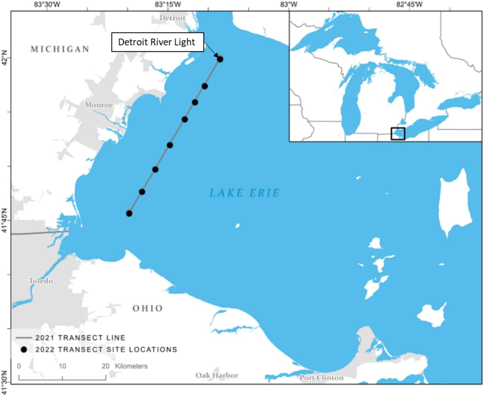
Map of the study area in the western basin of Lake Erie, showing monthly sampling locations along a transect in 2021 and 2022. Sampling extended from the Detroit River Light to approximately 12 km northeast of the Maumee River mouth.
The results showed that western Lake Erie is not a uniform environment. Instead, the study area could be divided into three distinct zones: an area primarily influenced by the Detroit River, a transition or mixing zone, and an area influenced by the Maumee River.
“We expected to find a gradient between the Detroit and Maumee river inflows, but I was surprised by how much the transition zones shifted from month to month and how distinct they were,” said Mancuso. “Even though the sampling stations stayed the same, the water’s physical and chemical properties consistently matched its source region rather than its location.”
Water closer to the Maumee River generally had higher concentrations of algae, phosphorus, organic material, and suspended solids. Water influenced by the Detroit River was generally cooler and more stable, with higher concentrations of ammonium, a form of inorganic nitrogen. Conditions in the mixing zone generally fell between those two extremes.
“Much of the research on harmful algal blooms in western Lake Erie focuses on phosphorus from the Maumee River, and we found that total phosphorus increased toward the Maumee during every sampling period,” said Mancuso. “However, we also found interesting patterns in bioavailable nitrogen, suggesting the Detroit River may be a source of nitrogen to the bloom. If we hadn’t sampled across the entire gradient, we likely would have missed that finding.”
Together, these findings show that the two rivers are doing more than simply delivering water to Lake Erie. Their distinct characteristics, and the way their waters interact, create a complex patchwork of environmental conditions across the western basin.
Where the Waters Meet – and Sometimes Don’t
The boundaries between the three zones were anything but fixed. Before the annual bloom developed in May and June, and again as the bloom began to decline in September and October, the mixing zone could stretch as wide as about 26-kilometers. During the peak bloom period in July and August, however, the transition zone narrowed dramatically (< 1-kilometer).
In other words, the broad boundary between these two very different water sources can tighten into a remarkably sharp dividing line just as the bloom season reaches its peak.
Water closer to the Maumee River was generally warmer, and light was absorbed or scattered more quickly, likely because of suspended material, organic matter, and increased phytoplankton concentrations. In contrast, water closer to the Detroit River was generally clearer, allowing light to penetrate deeper into the water column.
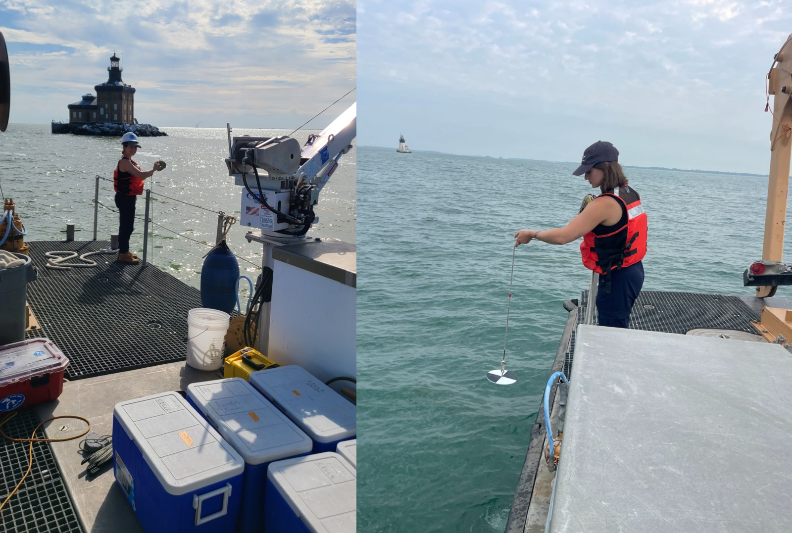
Jasmine Mancuso using a Secchi disk during a Lake Erie Transect sampling cruise. The Secchi disk provides a visual measure of water clarity, which is influenced by both biological particles (such as algae) and nonliving particles (such as sediments) in the water column. Photo credit: Paris Schofield (left); Andrew Camilleri (right).
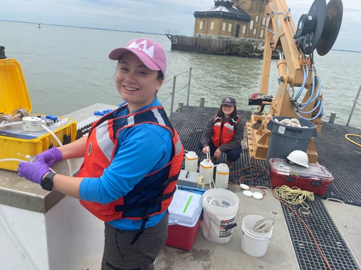
Paris Schofield (foreground) and Jasmine Mancuso (background) collecting water samples during a Lake Erie Transect cruise. Paris is filtering water samples for later measurement of carbon, while Jasmine is collecting water samples in bottles for laboratory analysis. Photo Credit: Kent Baker.
The researchers also documented two instances in which the two water sources remained vertically separated rather than immediately mixing. Cooler, denser Detroit River water was found beneath western Lake Erie water for an extended distance along the transect. To the researchers’ knowledge, these observations provide the first data-supported evidence of this type of extended vertical separation between the two river inflows in western Lake Erie.
“The western basin of Lake Erie is typically well mixed because it’s shallow and strongly influenced by wind,” said Mancuso. “We were surprised to find instances of the slightly cooler, denser Detroit River water wedging beneath the western basin water, extending for nearly the entire length of the transect and creating slight water column stratification. With a few more years of data, we now know this is an uncommon but recurring phenomenon. It’s still unclear how long this vertical separation lasts or what its implications are, but because the Detroit and Maumee river inflows are so different, it could have important effects on the lake’s ecosystem.”
These events may influence where nutrients and other resources are distributed in the water column, potentially affecting phytoplankton growth and bloom development. More research is needed to determine how often these events occur and how strongly they influence blooms.
The Maumee River Brings Phosphorus, but What About Nitrogen?
The study reinforces the important role of the Maumee River in western Lake Erie bloom dynamics. Phosphorus concentrations generally increased toward the Maumee River, and chlorophyll and suspended material also generally increased closer to the river during the active bloom season. These conditions can be favorable for Microcystis, a type of blue-green algae that commonly dominates harmful algal blooms in western Lake Erie.
The study also points to a potentially important role for the Detroit River, particularly in the availability of inorganic nitrogen. Like phosphorus, nitrogen is an essential nutrient for algae, and the balance between these nutrients can influence which types of algae grow and how harmful blooms may become. During the summer bloom season, concentrations of some forms of inorganic nitrogen often decreased toward the Maumee River. At the same time, concentrations near the Detroit River remained relatively steady and were sometimes higher than those closer to the Maumee River.
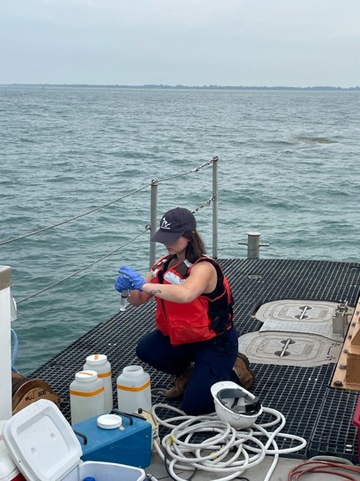
Jasmine Mancuso filtering Lake Erie water during a Lake Erie Transect cruise to prepare samples for laboratory analysis of dissolved inorganic nutrients, which are forms of nutrients readily available for algae to use. Photo Credit: Andrew Camilleri.
“Because of the sheer size and volume of the Detroit River, it makes up a large portion of the water in western Lake Erie, so what’s in that water matters,” said Mancuso. “While phosphorus is a major driver of how much algae can grow, nitrogen can influence the composition and toxicity of the algal community. With more data, we’re seeing an even stronger pattern of ammonium, the form of nitrogen preferred by algae, decreasing in concentration from the Detroit River toward the Maumee River. This suggests the Detroit River may be an important source of nitrogen to the annual bloom, which typically forms closer to the mouth of the Maumee River.”
These patterns suggest that the Detroit River may provide a source of inorganic nitrogen to areas where nitrogen is being drawn down during the bloom season. This could have implications for bloom dynamics and potentially for microcystin production, but the study does not establish a direct cause-and-effect relationship. More research is needed to understand how nitrogen supplied by the Detroit River interacts with other environmental factors and affects Microcystis and toxin production.
The finding highlights an important point: understanding western Lake Erie blooms requires looking beyond a single nutrient or a single river.
A Tale of Two Bloom Seasons
The two years of the study demonstrated just how much bloom conditions can vary from year to year. In 2021, the Microcystis bloom covered a larger area at its peak, about 1,373 square kilometers, but was less concentrated. In 2022, the bloom covered about 1,077 square kilometers but was more concentrated, particularly near the Maumee River mouth. Peak chlorophyll concentrations, a measure scientists use to estimate the amount of algae in the water, near the Maumee River were also higher in August 2022 than in August 2021.
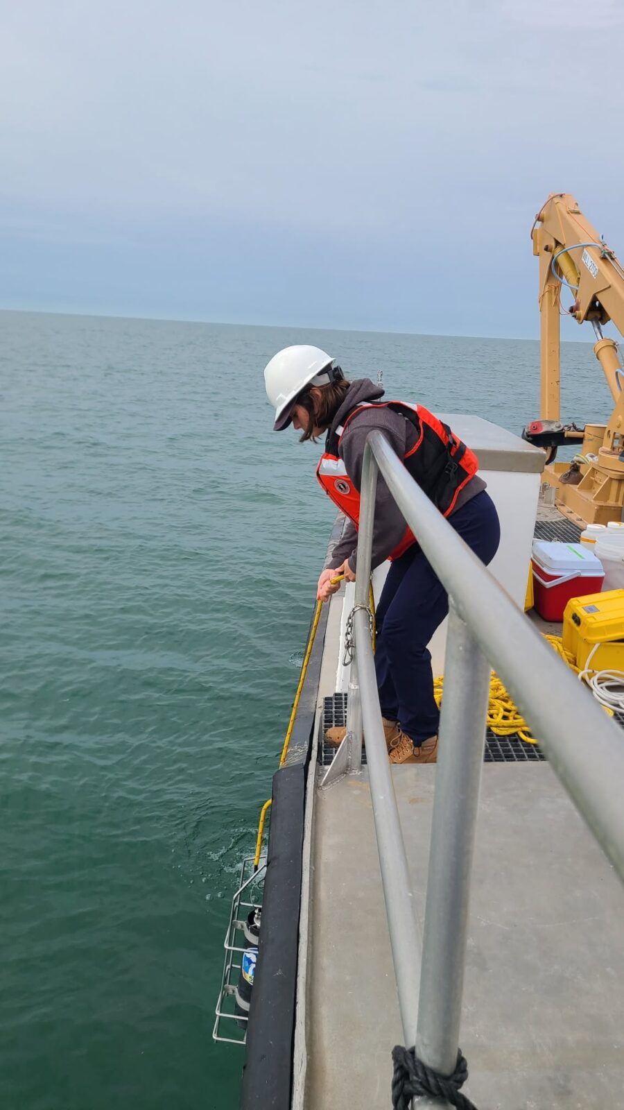
Jasmine Mancuso deploying a FluoroProbe during a Lake Erie Transect sampling cruise. The FluoroProbe measures the amount and types of algae present throughout the water column. Photo credit: Paris Schofield.
“I was surprised and delighted by how different the two years of data were in terms of algae concentration and composition across space and time,” said Mancuso. “We know algae respond quickly to their environment, but it was exciting to see that in action and explore why the two years differed. With additional years of data, we’re starting to identify which patterns are consistent over time and where we see year-to-year variation.”
The differences between the two years may be partly related to precipitation and river conditions. The Lake Erie basin experienced a dry spring followed by a wetter summer in 2021, while 2022 was comparatively dry later in the year. These contrasting conditions likely influenced river flows, nutrient delivery, mixing, and bloom distribution.
The wetter conditions in 2021 may have helped disperse the bloom more broadly across western Lake Erie, while the drier conditions of 2022 may have contributed to a bloom that remained more concentrated near the Maumee River.
The two years also differed in their phytoplankton communities. In 2021, diatoms remained relatively abundant later into the summer and fall, while 2022 showed a more typical seasonal shift toward greater cyanobacteria abundance during the bloom season.
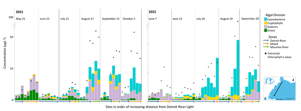
Changes in the amount and types of algae across the western basin of Lake Erie. Each bar shows the total amount of algae in a water sample collected 1 meter below the surface, while the different colors show the four main groups of algae: cyanobacteria (blue-green algae), cryptophytes, diatoms, and green algae. Black circles show chlorophyll levels, an indicator of the total amount of algae in the water. Sampling locations extend from the mouth of the Detroit River to the mouth of the Maumee River, and colored arrows mark different water zones identified from satellite images.
These differences highlight why there is no single set of conditions that defines every Lake Erie bloom. The timing, location, and intensity of blooms can be shaped by the interaction of nutrient availability, river discharge, precipitation, water temperature, light conditions, wind, and water movement.
Putting the Pieces Together
Harmful algal blooms in western Lake Erie are often discussed in terms of nutrient inputs, particularly phosphorus delivered by the Maumee River. This study shows that the Maumee River remains a major source of nutrients that can support bloom development, but the environmental conditions associated with blooms are shaped by the interaction between the Maumee River, the Detroit River, and the lake itself.
The two rivers create different conditions for water temperature, light availability, nutrients, suspended material, and phytoplankton communities. The transition zone between them adds another layer of complexity, and its size and location can change dramatically throughout the year.
The study also shows why monitoring the western basin requires sampling across a range of locations. While measurements near the Maumee River are essential for tracking nutrient inputs and bloom development, they don’t capture the full range of conditions across western Lake Erie. Including the Detroit River, the dynamic mixing zone, and areas farther offshore provides a more complete picture of how water quality and phytoplankton communities change throughout the basin.
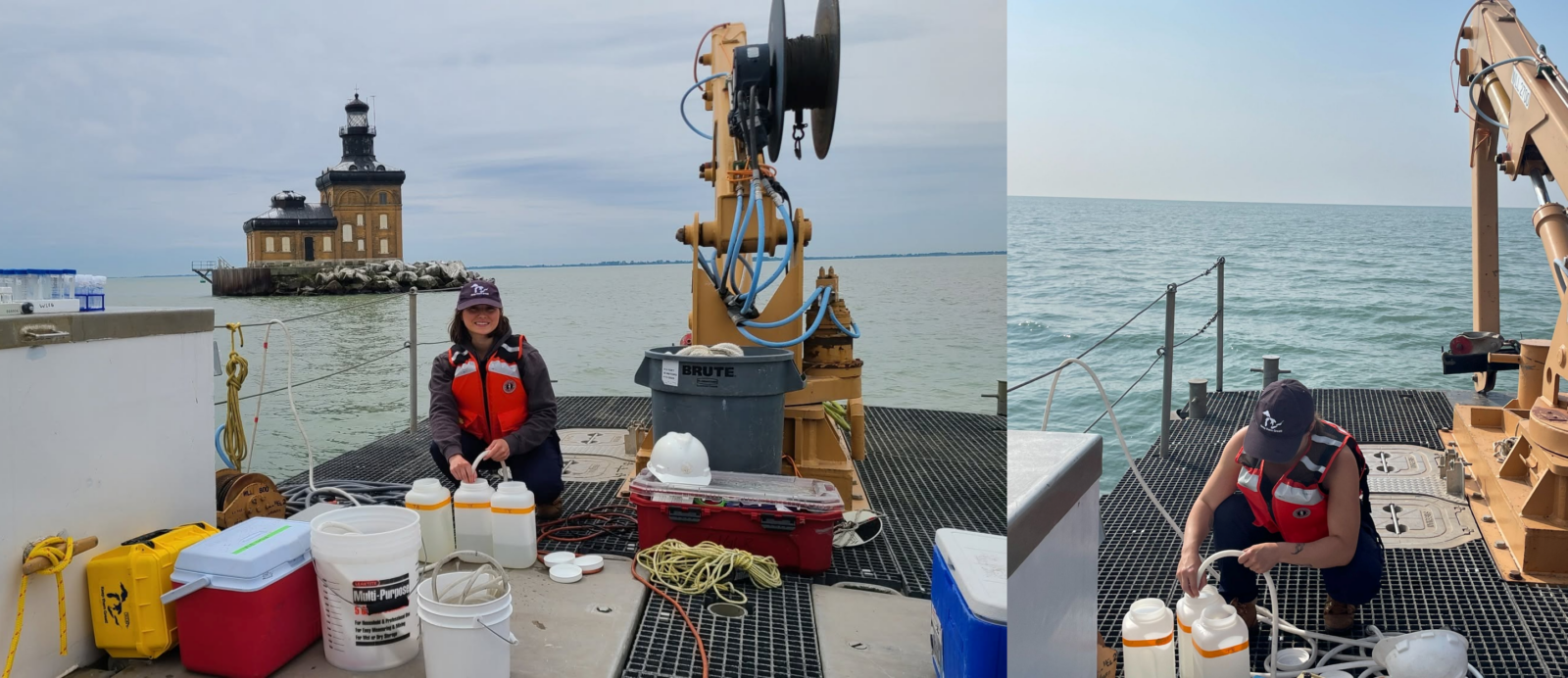
Jasmine Mancuso collecting 4-liter water samples during a Lake Erie Transect cruise. The samples are later analyzed in the laboratory for a variety of water quality and biological parameters. Photo Credit: Paris Schofield (left); Andrew Camilleri (right).
“Much of the research on harmful algal blooms in western Lake Erie has focused on the Maumee River because it is widely recognized as a key contributor to annual bloom development,” said Mancuso. “Our research provides a broader picture of what’s happening in the basin before, during, and after the blooms. The mixing of the Detroit and Maumee river plumes may influence the characteristics of the bloom each year, and our sampling transect, which spans a wide range of environmental conditions, also provides data that can help improve models used to forecast future harmful algal blooms.”
By better understanding how these two major river systems interact, scientists can continue improving models and forecasts of the factors that influence the size, location, concentration, and severity of harmful algal blooms in western Lake Erie.
Ultimately, “this study shows that harmful algal blooms are shaped by more than nutrients alone. The interaction between the Detroit River, the Maumee River, weather, and the lake’s physical environment creates constantly changing conditions that influence when, where, and how blooms develop,” said Mancuso. “As we continue collecting data across the western basin, we hope to improve bloom forecasts and deepen our understanding of the environmental conditions that shape harmful algal blooms in Lake Erie.”
Additional Resources:
Want to stay connected with CIGLR? Subscribe and follow us on social media to receive the latest news, seminar announcements, and updates from across the Consortium.
Follow us on: Facebook, Instagram, Bluesky, X, LinkedIn, YouTube, Flickr