Strengthening Safety on the Ice: Recapping Sea Ice Forecast Workshops in Western Alaska
In Alaska, landfast ice is more than just a landscape, it’s a frozen highway and a lifeline for subsistence hunting. But as the Arctic changes, this vital coastal ice is becoming increasingly unpredictable. For many, it no longer follows long-held seasonal patterns, making it harder to know when it is safe to set a crab pot or travel between villages.
To help address these challenges, the Cooperative Institute for Great Lakes Research (CIGLR) and Northwest Planning, LLC hosted a series of community workshops across Western Alaska in 2026 to support the development of an improved sea ice forecasting tool. On February 24–25, the project team traveled to St. Lawrence Island to host workshops in the Villages of Savoonga and Gambell. A third workshop followed on April 16–17 at the University of Alaska Fairbanks (UAF) Northwest Campus in Nome.
These workshops shared project updates while gathering community perspectives to help shape the design and functionality of the forecast tool. Savoonga, Gambell, and Nome were selected collaboratively by CIGLR and Northwest Planning, LLC to reflect both island and mainland perspectives across the Norton Sound region, each with distinct relationships to landfast ice. Insights from these workshops will help guide development of the project’s beta sea ice forecast, designed to support safer travel, subsistence activities, emergency response, and other community needs.
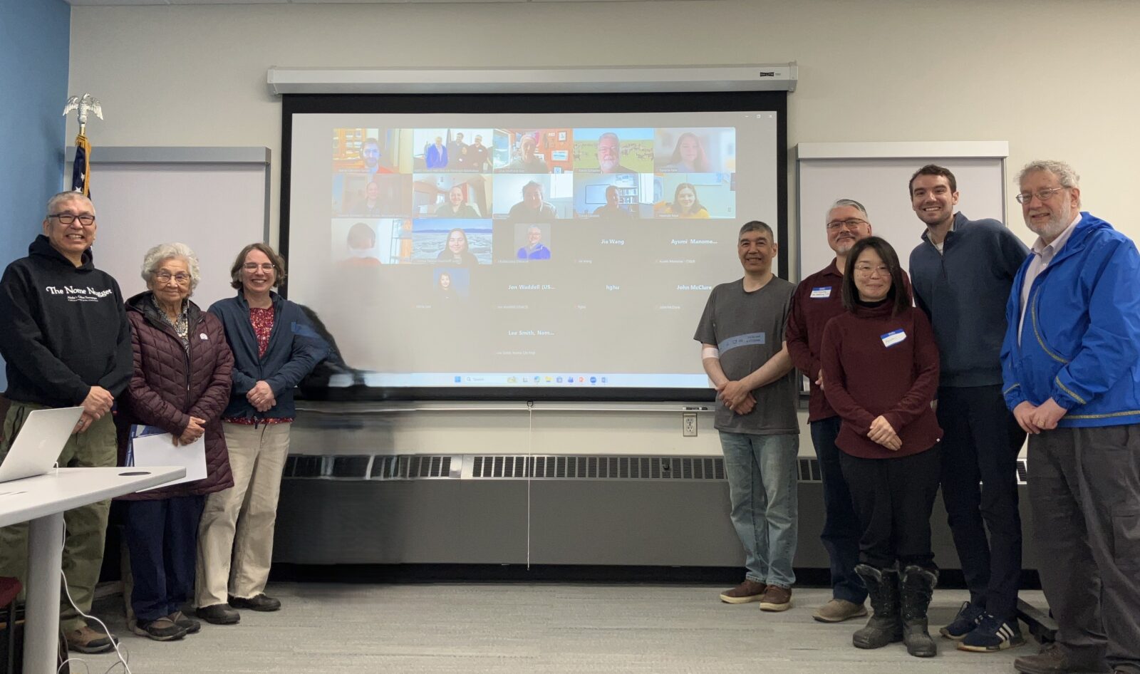
Community members and partners gathered in Nome, Alaska for the Sea Ice Forecast Project Workshop at the UAF Northwest Campus (April 16–17, 2026).
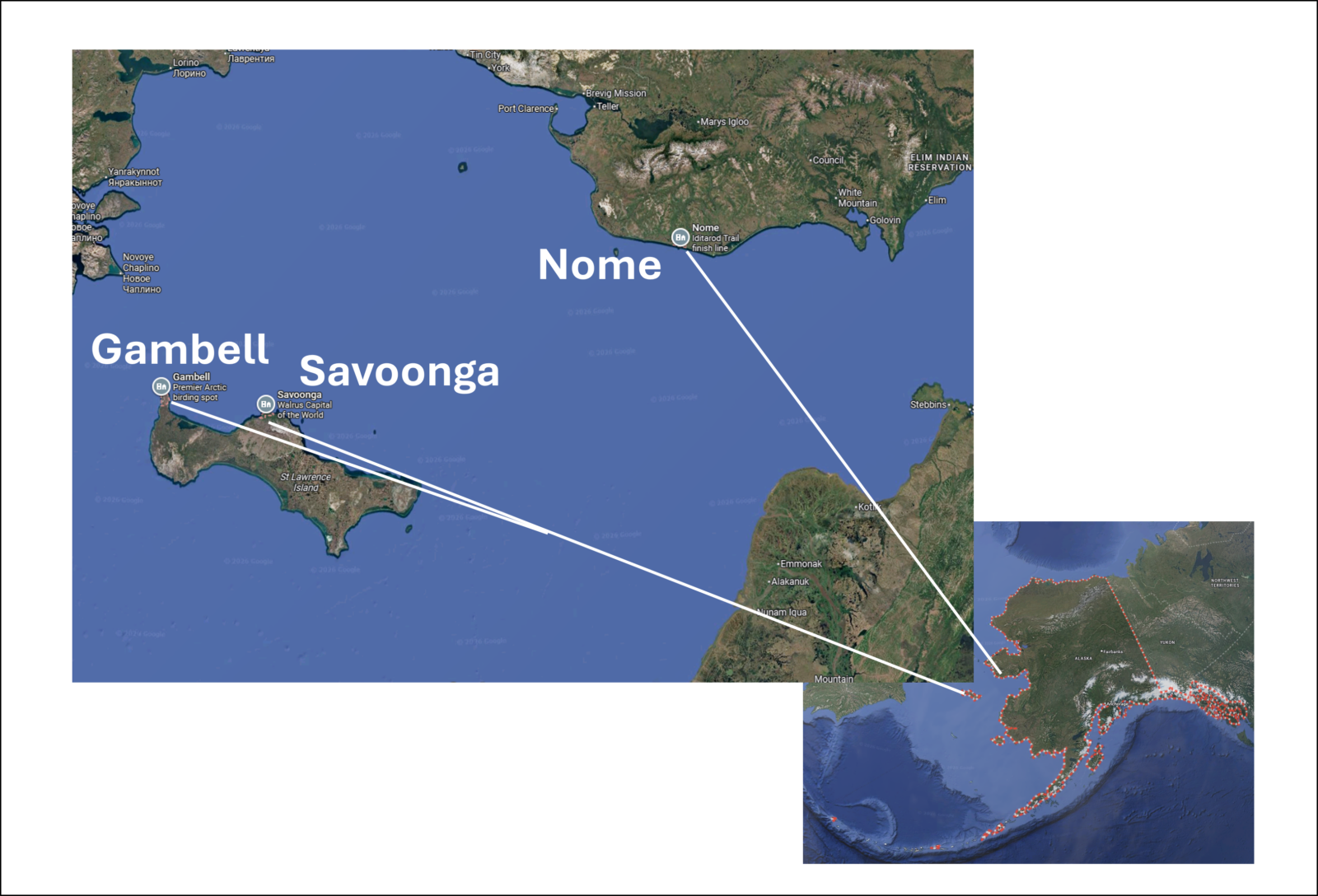
Map of Alaska workshop locations. The project team hosted workshops in the villages of Savoonga and Gambell on St. Lawrence Island on February 24–25, followed by a third workshop on April 16–17 at the University of Alaska Fairbanks (UAF) Northwest Campus in Nome.
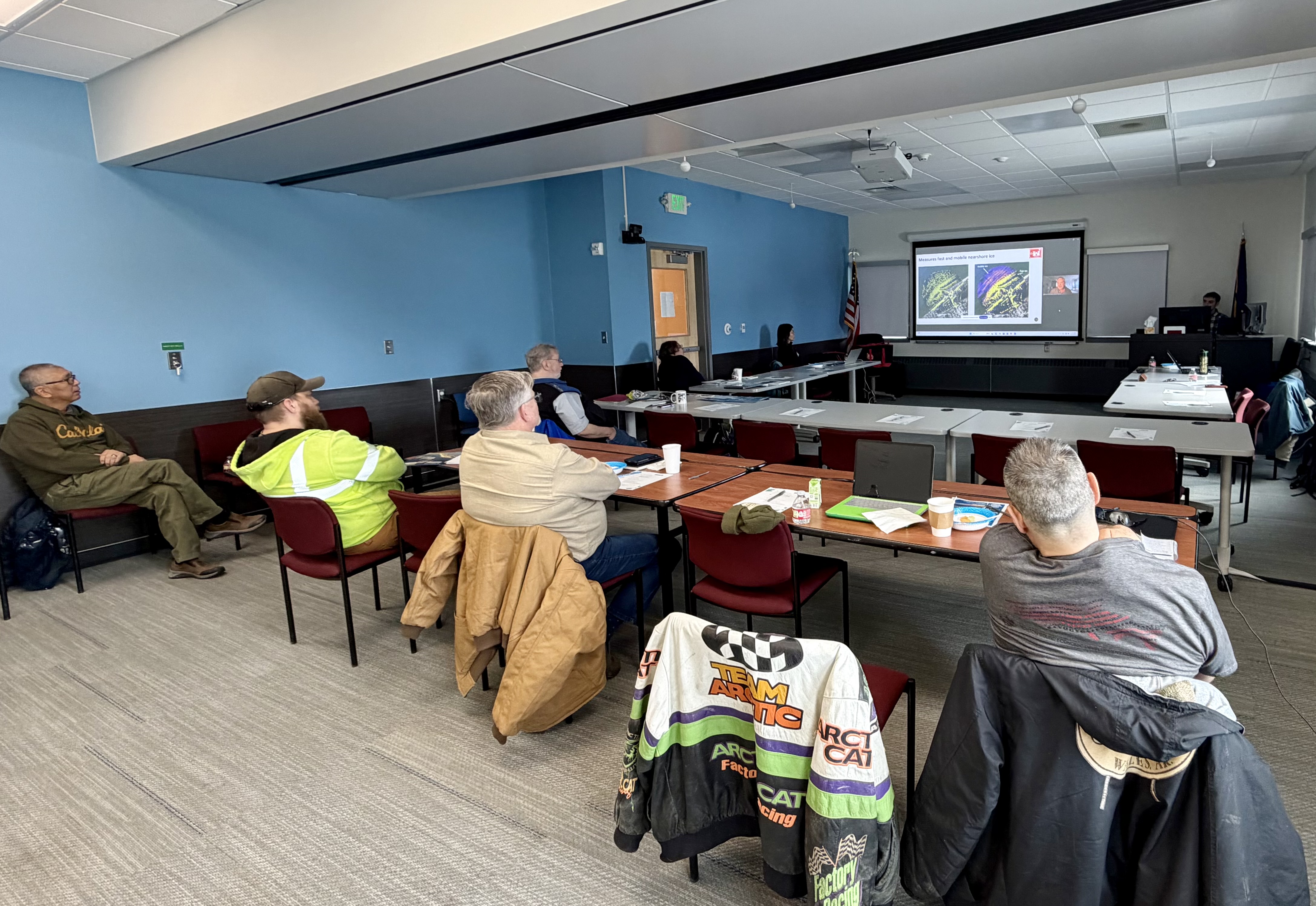
Community members and partners listen to presentations and participate in discussion at the Sea Ice Forecast Project Workshop held in Nome, Alaska (April 16–17, 2026).
What is Landfast Ice?
A major focus of the workshops was understanding the unique dynamics of landfast ice (also known as shorefast ice). Unlike “drift ice” that moves freely with the wind and currents, landfast ice is “fastened” to the coastline.
For communities like Nome and those on St. Lawrence Island, this ice provides a platform for:
-
- Subsistence Hunting: Allowing safe access to traditional seal and walrus hunting areas.
- Winter Crabbing: Supporting winter crabbing operations, where unpredictable ice can lead to lost equipment and catch.
- Transportation: Creating safe travel corridors between coastal communities and surrounding areas.
Bridging Technology and Traditional Knowledge
The workshops were led by Dr. Ayumi Fujisaki-Manome and John McClure from CIGLR, alongside Tom Ukallaysaaq Okleasik of Northwest Planning, LLC. Together, they brought expertise in sea ice modeling, community engagement, and Indigenous-led facilitation to support meaningful conversations with local residents.

CIGLR Associate Director & Associate Research Scientist, Dr. Ayumi Fujisaki-Manome.
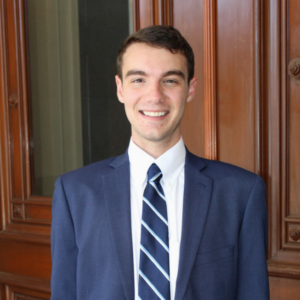
Dr. Ayumi Fujisaki-Manome serves as the main science Principal Investigator on the project. Her research program utilizes advanced numerical geophysical modeling to understand how the interactions between ice, oceans, and lakes impact large-scale phenomena like weather, storm surges, and ice melt. By feeding her scientific findings back into these models, her work directly improves the predictability of hazardous ice and weather events to support safety and resilience across cold regions, including the Great Lakes, the Arctic Ocean, the Sea of Okhotsk, and the Alaskan coastal region.
“Landfast ice is an integral part of Alaska’s natural and socio-cultural systems,” said Dr. Fujisaki-Manome. “However, monitoring and predicting landfast ice conditions remains a challenge due to its highly dynamic nature and the spatial scale involved, too small to be resolved by global weather or ocean forecast models, yet too large to be comprehensively captured by coastal radar systems. This project addresses that gap by using a state-of-the-art sea ice model with significantly higher spatial resolution than traditional models. Using this calibrated model, the team also aims to advance understanding of how tides and storm surge influence landfast ice stability.”
CIGLR Research Engagement Specialist, John McClure.
John McClure, a member of CIGLR’s Research Engagement Team, works alongside her to focus on bridging the gap between this complex science and practical community needs.
“Through in-person community engagement in Alaska, my work aims to ensure the development of a culturally and socially relevant decision support tool that provides actionable information relevant to local communities,” said McClure. “By using collaborative methods like community workshops, this project strives to better understand local priorities and build a community-informed forecast tool that delivers timely and precise forecasts to support subsistence and sea ice users.”
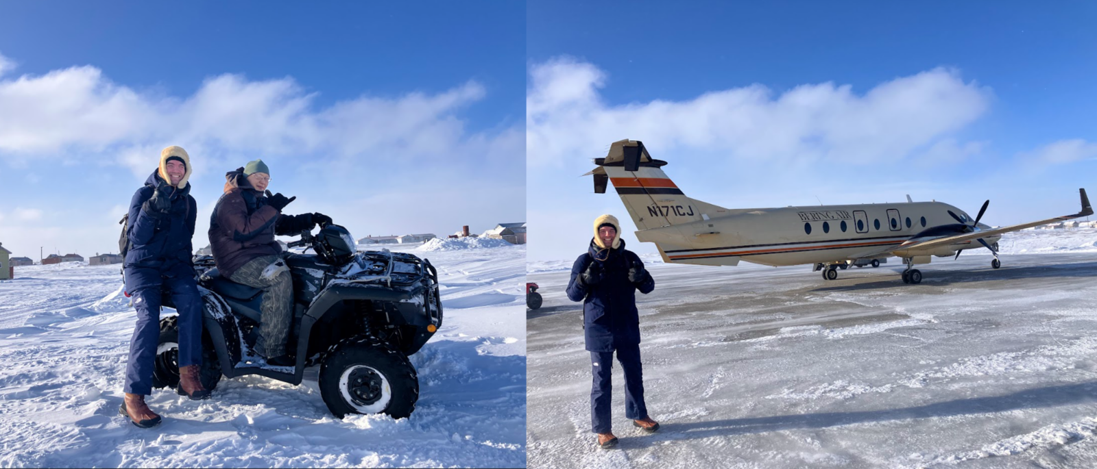
Traveling to St. Lawrence Island, Alaska, in February required many warm layers and multiple forms of transportation. Here, John McClure prepares for the journey to engage with community members during the Sea Ice Forecast Workshops.
Preparing for the February workshops required extensive coordination, particularly for travel to St. Lawrence Island. John and Ayumi worked closely with Tom to organize logistics for visits to Savoonga and Gambell, allowing for direct engagement with communities whose daily lives depend on reliable access to landfast ice.
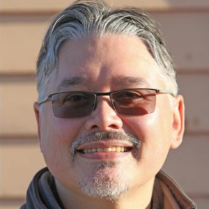
Founder of Northwest Planning, LLC, Tom Ukallaysaaq Okleasik.
To ensure this work is rooted deeply in the region, the team partnered with Tom Ukallaysaaq Okleasik, the Founder of Northwest Planning, LLC, a 100% Indigenous-led consulting company proudly based in the U.S. Arctic. He founded the company after recognizing the need for Indigenous-led expertise to support projects across Alaska through planning, community relations, and cross-cultural facilitation. By bringing a deep knowledge of local communities and regional resources, Northwest Planning, LLC helps ensure the project achieves its technical goals while genuinely honoring local perspectives and priorities.
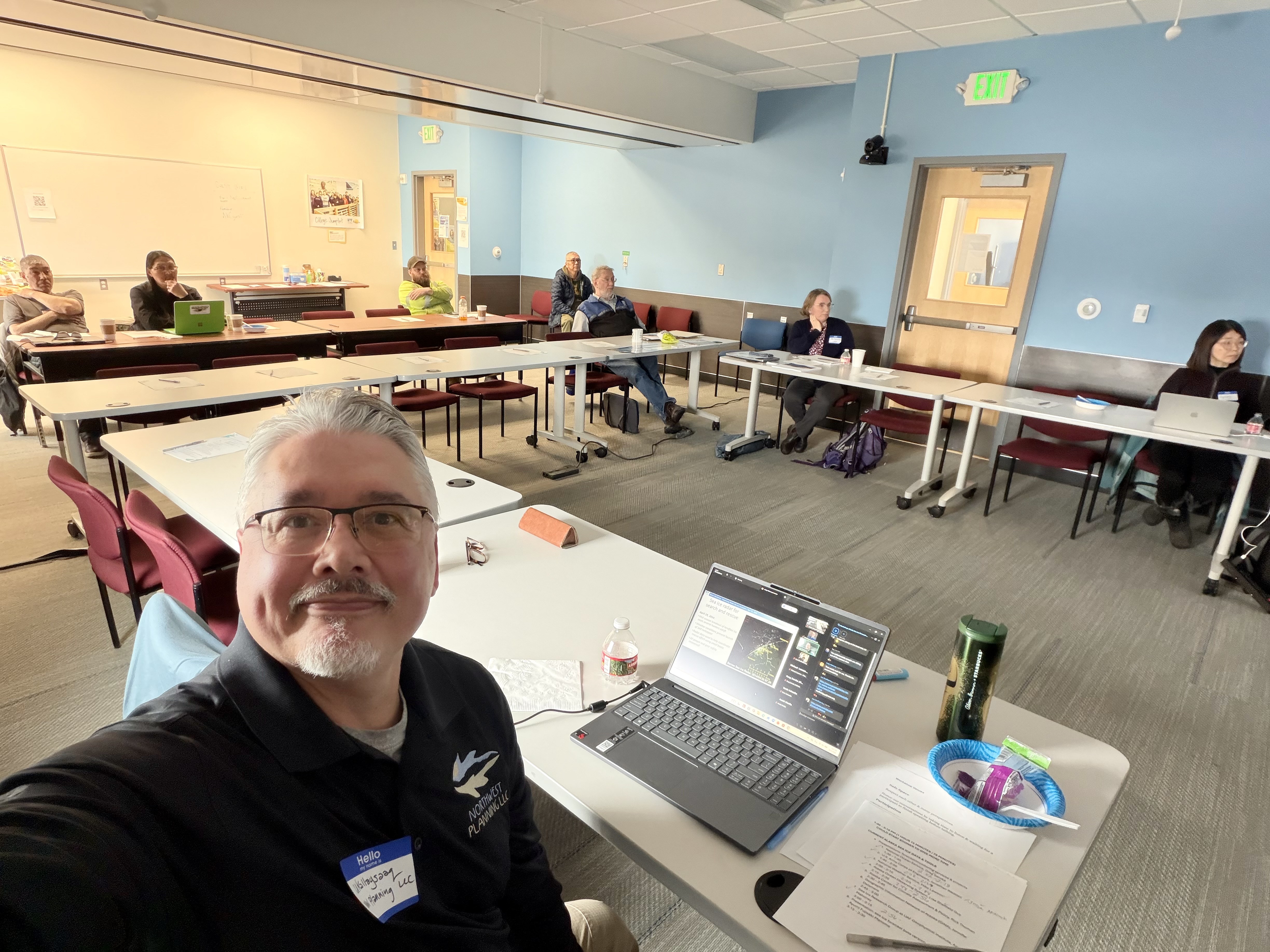
Tom Ukallaysaaq Okleasik, the Founder of Northwest Planning, LLC, shares a working photo from Sea Ice Forecast Project Workshop.
The core of this project is “collaborative design.” Rather than researchers simply handing over a finished tool, they are building it alongside the people who live and work on the ice. This collaborative approach is a hallmark of the Research Engagement Program at CIGLR, which specializes in creating a “two-way interaction” between scientists and the people who actually use their data. Just as CIGLR works with Great Lakes anglers, ship captains, and coastal managers to turn research into action, John and the team are bringing that same engagement philosophy to the Arctic.
By directly involving local stakeholders, rights holders, and end-users, the team ensures the final tool isn’t just scientifically advanced, but also easy to use, easy to access, and directly responsive to the community’s most pressing safety needs.
Okleasik emphasized that the work is rooted in collaboration with traditional knowledge. “It’s a way to incorporate technology into the community… deciding, ‘do I set a crab pot today?’ and ‘what would that look like in three days?’” he said in a recent interview with KNOM Radio Mission.
A central goal across all three workshops was to hear directly from residents, organizations, and sea ice users about how they make decisions on the ice and what information would be most valuable in a forecasting tool. Discussions focused on making the forecast easy to access, easy to interpret, and useful across a wide range of activities, including subsistence hunting, commercial operations, emergency response, and travel.
Community feedback from these sessions will directly inform the design of the beta sea ice forecast, ensuring it reflects local priorities and complements, not replaces, existing knowledge and decision-making practices.
Why Michigan?
Although this project is rooted in Alaska, the technical expertise comes from an unexpected place: the Great Lakes.
The University of Michigan’s CIGLR team brings experience modeling lake ice systems that closely resemble coastal ocean conditions. The Great Lakes, which form the largest freshwater coastline in the United States, provide a useful analogue for Arctic coastal ice dynamics.
“Of course there is no salinity in Great Lakes ice; however, its characteristics are similar to those found in marginal ice zones of the oceans, including Alaska’s coastal waters,” said Dr. Fujisaki-Manome. “Our modeling expertise prepares us well for coastal sea ice research in Alaska and other cold regions.”
Her research spans the Great Lakes, Arctic Ocean, Sea of Okhotsk, and other cold-region systems, with a focus on improving predictive models for ice and weather hazards.
How the Forecast Tool Works
The team’s modeling expertise provides the foundation for a forecasting system designed to translate complex environmental data into practical information for local communities.
The project’s centerpiece is a web-based forecasting system that provides short-term, hourly updates on ice movement up to 72 hours in advance.
The system combines satellite imagery and buoy observations with NOAA’s Global Forecast System (GFS), ocean conditions from the Global Real-Time Ocean Forecast System (tracking currents and temperatures), and coastal water levels from the Surge and Tide Operational Forecast System (tides and storm surge). These inputs are processed using the Los Alamos Sea Ice Model (CICE6) to generate high-resolution forecasts at 1.5 km scale.
The result is an animated, visual map of ice concentration and movement. Unlike traditional text-based forecasts, this tool allows users to track how ice is expected to shift, form, or break apart, helping identify safer travel routes and potential breakout risks.
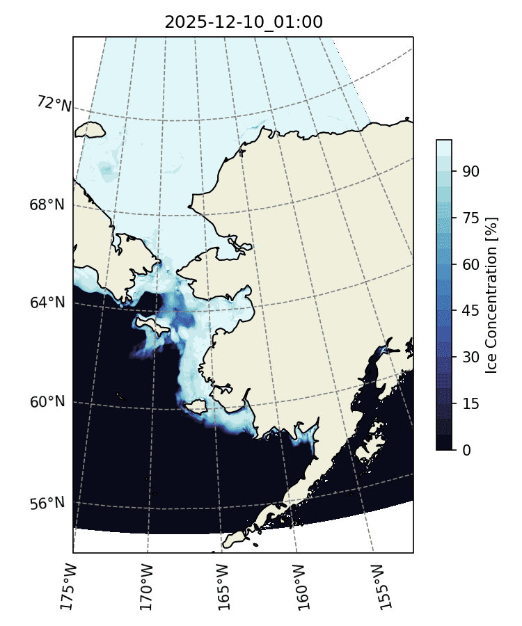
A sample forecast from the updated sea ice forecasting model from the CIGLR.
What’s New in the Updated Model?
The project is currently in its second year of a three-year effort (through July 2027) to modernize the Arctic Sea Route Nowcast/Forecast System. Work is now focused on testing and refining the model, with community input guiding improvements to the user interface.
Key upgrades include:
-
- Higher resolution: Improved from 5 km to 1.5 km, offering a much clearer view of coastal areas like Nome.
- Extended forecasts: Current outputs provide hourly forecasts up to 3 days, with plans to extend to 10 days.
- Tidal integration: Improved representation of tides, a key factor in landfast ice stability and breakup.
Get Involved & Stay Informed
Community input from Savoonga, Gambell, and Nome continues to shape the development of the forecast system. As the project moves toward completion in 2027, the team welcomes continued feedback to ensure the tool reflects local priorities, knowledge, and safety needs.
The project team is also working with local knowledge holders, community members with deep, generational experience of ice and weather, to help guide development and interpretation of the forecast system.
You can explore the current progress and news here:
-
- Alaska Sea Ice Forecast Prototype: Alaska Sea Ice Prediction Tool
- Official Project Page: NOAA Global Ocean Monitoring & Observing
- The Nome Nugget, Alaska’s Oldest Newspaper: Researchers Develop Shorefast Sea Ice Prediction Tool
- KNOM Radio Mission: Updated Sea Ice Forecast Model on The Way with Huge Leap in Resolution
- Alaska News Nightly: Researchers Develop a New Sea Ice Forecasting Tool that Could Help Subsistence Users Seeking a Safe, Solid Platform
Questions or Feedback? Contact Ayumi Fuisaki-Manome ([email protected]) or John McClure ([email protected]). Your input ensures these tools serve the safety needs of the community.
This project is funded by the NOAA Global Ocean Monitoring and Observing (GOMO) Arctic Research Program (ARP).