Great Lakes Forecasting
Great Lakes forecasts predict future conditions that affect people’s lives and support informed decision making.
Conditions in the Great Lakes affect the daily lives of tens of millions of people, impact the multi-trillion dollar regional economy, and influence resource management decisions. Predictions of future water level fluctuations, ice extent, snowfall, waves, temperature and more facilitate planning and decision making that promote safety and efficiency. Using the real-time data from buoys and other observing systems in the Great Lakes, we are producing model forecasts and predictions for the benefit of society.
With our partners at NOAA GLERL, CIGLR is developing and improving Great Lakes forecasts and hindcasts. Our activities in this area include:
1. Modeling Great Lakes Ice
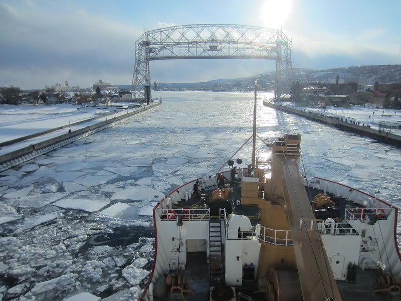
U.S. Coast Guard Cutter Mackinaw is an icebreaking vessel on the Great Lakes that assists in keeping channels and harbors open to navigation. Here, the USCGC Mackinaw arrives in Duluth via Lake Superior on March 24, 2014. Click to learn more about the The Great Lakes Operational Forecast System (GLOFS). Photo Credit: NOAA.
Ice cover in the Great Lakes plays a key role not only in regional weather, but also in environmental quality and economic prosperity. Our ability to model and predict Great Lakes ice cover has broad implications for forecasting winter weather, understanding lake water levels, providing information for safe ice-related recreation, and helping inform decisions for Great Lakes commercial shipping and fishing industries.
NOAA through the collaboration between OAR/GLERL, National Ocean Service (NOS) and academia has developed and implemented the Great Lakes Operational Forecast System (GLOFS), a 3-d numerical lake forecast modeling system to provide critical forecast guidance on water levels, water currents and water temperature to mariners operating in the Great Lakes Marine Transportation System (GLMTS). In this project, gaps in navigational support are addressed by focusing on the interaction between the National Water Model (NWM) and coastal hydrodynamic models at key points of navigational interest: ports and large rivers that are not resolved in the existing NOAA modeling infrastructure.
By using models that include the Finite-Volume Community Ocean Model for Great Lakes ice circulation (FVCOM+ice) and comparing observational data from the Arctic, we are improving Great Lakes ice forecasts/hindcasts and gaining insight into how changing climates might impact future Great Lakes ice cover.
2. Western Alaska Storm Surge Forecasting
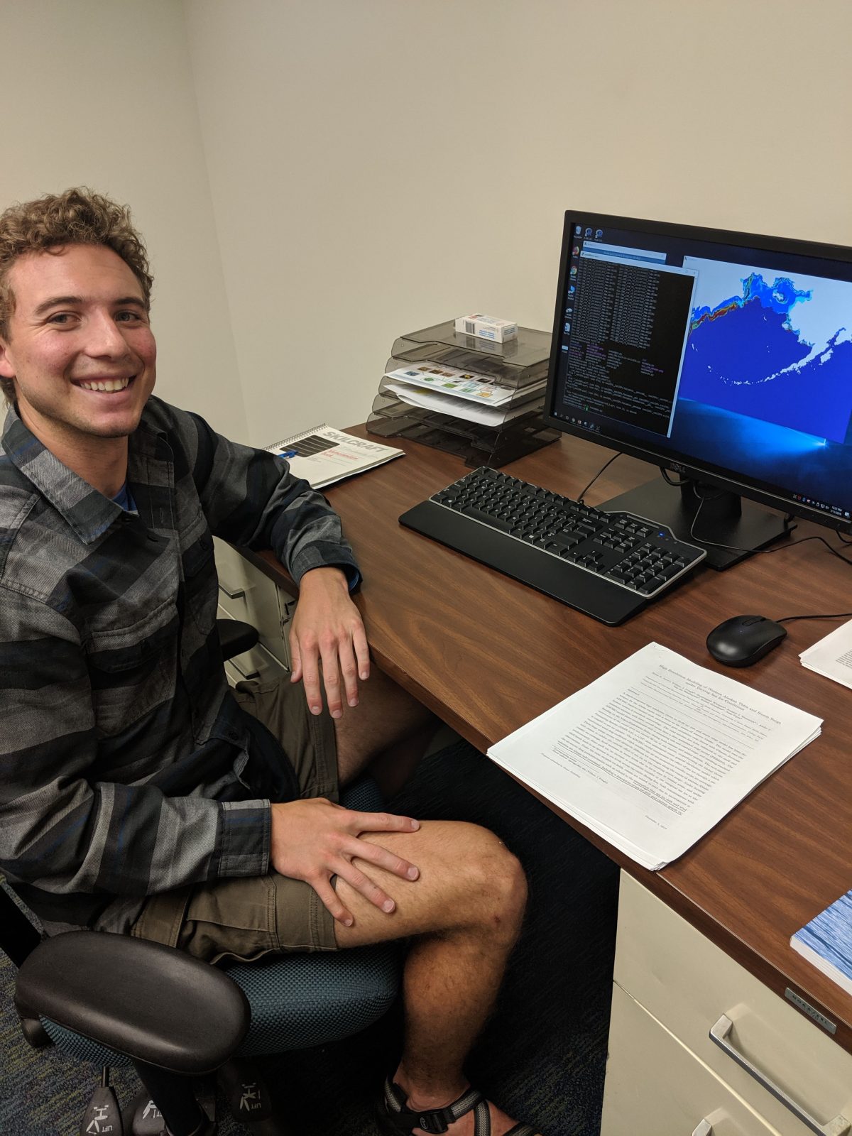
Click to watch 2019 Great Lakes summer fellow, Clay Carufel, talk about his project that focused on the impacts of storm surge on the coast of western Alaska.
Coastal storms threaten human safety in western Alaskan communities, where a combination of complex geography, highly energetic atmospheric and ocean circulation, wind, waves, and an extensive coastal floodplain leave them highly vulnerable to hazardous flooding. Western Alaska is limited in weather observations and replete of nearshore current and circulation information, leaving regional forecasters and the communities they serve severely limited in their ability to assess the impact risk of storm events. These problems have become even more vexing in light of continued diminishing ice conditions in the fall and winter months, when the most intense storm events occur.
A team of scientists from the Alaska Ocean Observing System, Axiom Data Science, CIGLR, NOAA, University of Notre Dame, and University of Texas-Austin to deliver improved storm surge, wave, and ice forecasting capacity to the NOAA National Centers for Environmental Protection (NCEP) and NOAA National Ocean Service (NOS). Funding from the U.S. Integrated Ocean Observing System (IOOS) is supporting the development of an integrated modeling system for the coasts of Alaska. The end product from this project is the coupled surge-wave-ice model for the western Alaska region, with the goal to provide forecast officers with model forecast guidance they can use to issue or not issue warnings and advisories.
Their advanced sea ice modeling system, based on the Los Alamos Sea Ice Model (CICE), will enable detailed representation of nearshore and offshore sea ice behavior such as landfast ice and increased surface roughness due to ridged ice, which impact surge and wave intensity. Currently, the team of scientists at CIGLR and NOAA GLERL leads the advancement of a sea ice model component based on CICE. Adequately depicting these processes is critical for accurate storm surge forecasting when the ocean is covered with ice. Thus far in the project, a standalone sea ice model has been successfully designed and verified using sensitivity studies and satellite measurements. The team continues to couple sea ice modeling components with the other physical modeling components like ocean and wave models, using the NOAA Environmental Modeling System (NEMS) in collaboration with scientists at the University of Notre Dame, the University of Texas-Austin, and the NOAA National Centers for Environmental Prediction. This project represents a major advancement in forecasting capacity to protect western Alaska communities and our lessons learned can be applied to ice-prone coastal regions elsewhere.
3. Lake Champlain Hydrodynamic Flood Forecasting System
Lake Champlain is an international body of water, spanning the border between the United States and Canada. It is located in a steep mountain valley, with the Adirondack Mountains of New York to the west and the Green Mountains of Vermont to the east. This mountainous setting, while picturesque, is an environment highly conducive to springtime flooding. As temperatures warm, rapid snow melt from the mountains along with spring showers can lead to sudden rises in the lake’s water levels. Lake Champlain has experienced several such flood events over the past decade, causing destruction of property and infrastructure in the binational basin. The largest of these occurred in 2011, during which time the basin remained flooded for a period of more than two months.
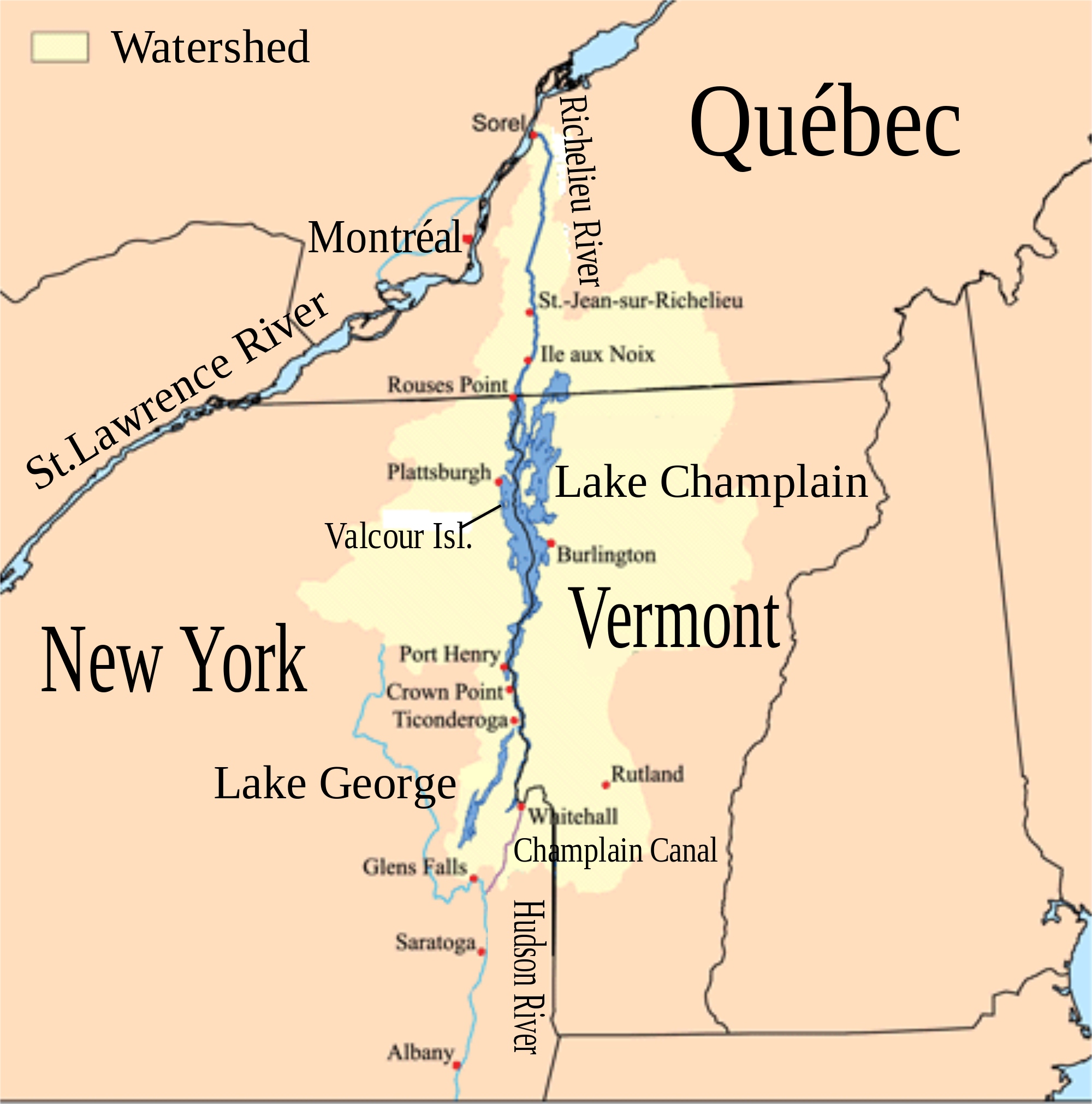
Lake Champlain, the Richelieu River, and the surrounding watershed (highlighted in light yellow).
To better anticipate and prepare for flood events, researchers at CIGLR are working with NOAA GLERL and the International Joint Commission (IJC) to develop a state-of-the-art flood forecasting model. The model is being developed in close collaboration with the NOAA National Weather Service (NWS), National Center for Atmospheric Research (NCAR), and emergency managers, who will use results from the Lake Champlain forecasting system to provide advance warning of floods to residents and other area stakeholders. The model starts with a detailed 3D representation of Lake Champlain, and uses physics to predict how water will move through the lake in response to outside forces such as river inflows and local meteorology. By feeding up-to-date weather and river forecasts into the model, researchers are able to predict how the lake will respond to future conditions, and produce 5-day forecasts of water levels, currents, and waves for the lake. These forecasts will improve the ability to plan and prepare for floods and, ultimately, reduce the severity of their impacts.
The accuracy, or skill, of the Lake Champlain forecast model was tested by simulating events that have already occurred, such as the record flood of 2011. Results from these “hindcast” simulations showed strong agreement with historic measurements that were taken in the lake at the time of the floods. The proven ability of the model to realistically simulate past flood events gives the researchers a high degree of confidence that it is capable of forecasting future events. The new flood forecasting model will be capable of resolving how flood conditions vary from location to location across Lake Champlain, which represents a major upgrade from existing tools used for forecasting in the basin. While we think of flooding as an influx of water, forces such as wind can significantly enhance the damage caused by flooding. Lake Champlain is only 14 miles wide from east to west, but is more than 100 miles long from north to south. When a strong wind blows over this long stretch of open water, it can “push” the water toward one end of the lake and also produce large waves on the surface. The ability to predict these wind driven impacts in addition to high lake levels is critical for understanding not just when the lake may flood, but where impacts may be most severe. Although the focus of the study is on flood forecasting, results from the model may benefit a variety of interests, such as boater safety, fishing, beachgoing, and scientific research.
4. Simulating Water Levels
In light of future climate scenarios, CIGLR is engaging in research to improve Great Lakes water budget estimates and water level simulations. The consequences of water level change for shipping, commerce, and human safety have been magnified by the persistently low lake levels in the Great Lakes during 1999–2012, the recent rebound since 2014, and coastal flooding of Lake Ontario in 2017. We are using the Weather Research and Forecasting (WRF) model to conduct historical (1975 – 2005) and future (2006 – 2100) water level projections. We are also supporting the International Joint Commission’s (IJC) need for understanding water levels and future water supplies in the Great Lakes, by creating a robust historical dataset and water budget estimate for each Great Lake that explains changes in observed water levels.
5. Runoff Risk Decision Support Tools
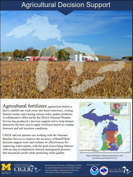
Many lakes and streams in the Great Lakes and upper Midwest region experience water quality issues related to agricultural runoff, some of which can be prevented by carefully timed decisions by farmers and applicators. When nutrients are applied during a period when the risk of surface runoff is high, nutrients intended to enrich the soil can end up in the water instead. Farmers lose revenue as their fertilizers wash away and crop yields suffer, while local and downstream waterways experience serious water quality consequences.
The water quality impacts of nutrient runoff have significantly been observed in the western basin of Lake Erie, which receives nutrient-laden water from watersheds dominated by agriculture (60-80 percent) and several large cities like Detroit, Toledo, and Monroe. Once in Lake Erie, the excess nutrients, along with the warm and shallow waters, create the perfect environment for the development of harmful algal blooms (HABs) which plague the lake annually.
In 2008, NOAA National Weather Service (NWS) North Central River Forecast Center (NCRFC) developed a real-time decision support tool to help guide the timing of fertilizer application based on current conditions and weather forecasts. Currently, the tools are being used in the upper Midwest including Michigan, Minnesota, Wisconsin, and Ohio, with ongoing efforts in New York, Indiana, and Illinois. The Ohio State University’s College of Food, Agricultural, and Environmental Sciences (CFAES) are evaluating how water quality in the Maumee River and western Lake Erie may improve when farmers and fertilizer applicators use the decision support tools. The team is using watershed models to simulate different surface runoff scenarios by altering the timing of fertilizer application.
The NOAA National Water Model (NWM) is a hydrologic model that simulates observed and forecasted streamflow over the entire continental United States (CONUS). The model framework operates by using the hydrological version of the Weather Research and Forecasting model (WRF-Hydro) to simulate components of the water balance, including soil conditions, precipitation, and runoff, at a very fine-scale resolution. Hydrologists from CIGLR and GLERL are working with the NCRFC, as well as collaborators from the National Center for Atmospheric Research (NCAR), to assess NWM ability to simulate surface runoff as well as develop an improved runoff risk tool that would incorporate real-time forecasts from the NWM. Transitioning to this next version of decision support tools hopes to improve the accuracy of runoff risk forecasts as well as having the benefits of using a continuously improving and operationally supported hydrologic model.
The overarching goal of this project is to improve runoff risk decision support tools which would hopefully lead to a more widespread, voluntary use from states and other stakeholders. Not only would farmers and producers save money and efforts by avoiding nutrient application before significant runoff events, but help reduce the amount of nutrient runoff from reaching large bodies of water, such as the Great Lakes. Water quality benefits from lower nutrient loads include reductions in harmful algal blooms and hypoxia in receiving water bodies.
6. Predicting Lake Effect Snow
Lake-effect snow (LES) is one of the most hazardous weather events in the Great Lakes region, creating dangerous transportation conditions, impacting power lines and electricity, and closing schools and businesses. However, it also drives the local economy during winter in many areas that rely on winter-related outdoor recreation (ice-fishing, skiing) for jobs. Forecasting LES events accurately both in timing and in the amount of snowfall is currently very difficult. To help with this problem, CIGLR is leading a project with National Weather Service (NWS) forecasters to reduce the uncertainties in their models and improve the LES forecasts, ice predictions, and visibility forecasts.
Currently, the National Oceanic and Atmospheric Administration (NOAA) is working to update the High-Resolution Rapid Refresh (HRRR) to a Finite-Volume Cubed-Sphere Stand-Alone Regional model known as FV3-SAR. The HRRR model is a NOAA real-time, hourly updated, cloud-resolving atmospheric model used for short-term weather forecasts. By incorporating updated lake surface conditions into the HRRR, the research team revealed significant improvements to lake-effect snowfall simulations, more accurately depicting the location and intensity of the events. NOAA will transition to the Unified Forecasting System (UFS), which brings together academic, government, and private sector researchers to develop a fully coupled model for the Earth system and unify operational model predictions, such as lake-effect snow forecasts, within NOAA.
By incorporating next-generation Great Lakes Operational Forecasting System (GLOFS) lake condition data, atmospheric models such as FV3-SAR continue to improve and bring model simulations of snowfall location and intensity closer to reality. These improved simulations can help local weather forecasters better predict and communicate the potential impacts from lake-effect snowfall events to help keep people safe during the winter months around the Great Lakes region.
7. Incorporating Human Dimensions
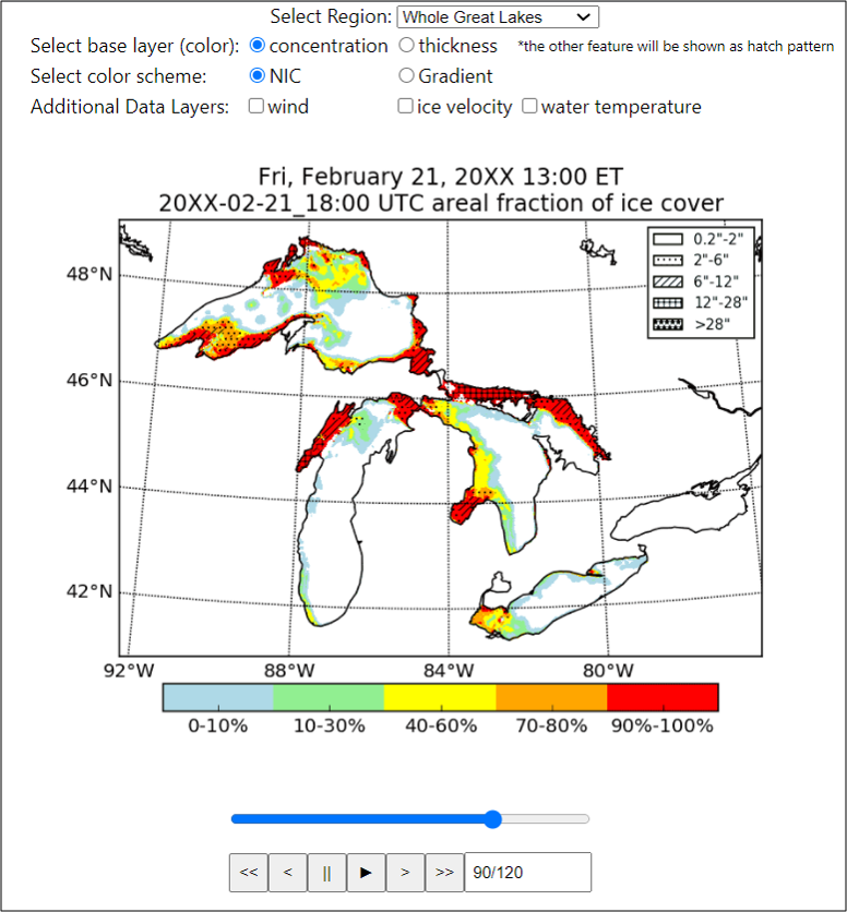
Example image from the Experimental Great Lakes Ice Forecast.
CIGLR and NOAA GLERL are working to improve the usability of NOAA’s Great Lakes Operational Forecast System (GLOFS) by including stakeholders in the design of a Great Lakes Ice Forecast. An easy-to-use ice forecast will be designed to help lake vessels and the 9th District U.S. Coast Guard (USCG) navigate dangerous ice conditions, prepare for emergency responses, and reduce risk of vessel damage due to ice. Workshops, surveys, and focus groups continue to be conducted to assess information needs and develop a forecast user interface. A stakeholder engagement report for the Great Lakes Ice Forecast workshop held on July 11th, 2019 in Cleveland can be read here.
Stay up-to-date on the most recent news and scientific media generated from our Great Lakes Forecasting research here:
Products & Resources
- Great Lakes Coastal Forecasting System (GLCFS) (website)
- The Great Lakes Operational Forecast System (GLOFS) (website)
- Great Lakes Water Level Dashboard (website)
- Great Lakes Water Levels (website)
- Great Lakes Ice Cover (website)
- Information about the Next-Generation Great Lakes Coastal Forecasting System (website)
- Lake-Effect Snow & Ice Forecasting (CIGLR factsheet)
- Water Levels & Coastal Flooding (CIGLR factsheet)
- Agricultural Decision Support (CIGLR factsheet)
- The National Water Model: America’s First National Water Forecast Model (NOAA factsheet)
- Great Lakes Water Levels Research at NOAA GLERL (NOAA GLERL factsheet)
- Ice Cover Research at NOAA GLERL (NOAA GLERL factsheet)
- MET Stations and Webcams (NOAA GLERL factsheet)
- Predicting Currents in the Straits of Mackinac (NOAA GLERL factsheet)
- Great Lakes Water Budgets (NOAA GLERL infographic)
- Record Setting Water Level Rise in the Great Lakes (NOAA GLERL infographic)
- Ice Research (bookmark)
News
- Researchers Aim to Improve Coastal Storm Surge Forecasting, The Cordova Times, 10/4/2020
- Improving Lake Effect Snow Forecasts, CIGLR 2020 Winter eNews, 03/2020
- Using the NOAA National Water Model to Guide Fertilizer Application and Improve Water Quality, CIGLR 2019 Summer eNews, 09/2019
- Climate change is driving rapid shifts between high and low water levels on the Great Lakes, The Conversation, 6/4/2019
- Researchers to sharpen Great Lakes ice alerts, Great Lakes Echo, 2/27/2019
- Forecasting Flood Events for the Lake Champlain-Richelieu River Basin, CIGLR 2018 Fall eNews, 12/2018
- Using Satellite Data to Improve Great Lakes Monitoring and Forecasting, CIGLR 2018 Summer eNews, 09/2018
- Predicting Great Lakes Ice, CIGLR 2018 Winter eNews, 03/2018
- Forecasting the Future of Lake Effect Snow, CIGLR 2018 Winter eNews, 03/2018
- November 2014 storms become case study for better lake-effect forecasting, The Buffalo News, 12/9/2017
- Forecasting lake-effect snow: Imagine a Great Lakes weather forecast that’s always right, Record Eagle, 12/7/2017
- Don Paul: Better lake-effect forecasts are coming, The Buffalo News, 11/24/2017
- Imagine a Great Lakes weather forecaster who’s always right, Great Lakes Echo, 11/20/2017
- Imagine a Great Lakes weather forecast that’s always right, News Advocate Manistee, 11/27/2017
- Imagine a Great Lakes weather forecast that’s always right, Capital News Service, 11/21/2017
- Predicting a Great Lake’s Response to a Warm Winter, Earth and Space Science News, 11/11/2016
- Warming of the Great Lakes Faster in Certain Regions, Nature World News, 8/24/2016
- What Caused Record Water Level Rise in the Great Lakes?, Earth and Space Science News, 7/21/2016
- Lake Michigan ice down 50 percentage points from two years ago, despite cold weather; Chicago Tribune, 2/17/2016
Publications
Alves, J.H., A. Chawla, H.L. Tolman, D.J. Schwab, G.A. Lang and G. Mann. 2014. The operational implementation of a Great Lakes wave forecasting system at NOAA/NCEP. Weather and Forecasting. 29(6):1473-1497. (DOI:10.1175/WAF-D-12-00049.1).
Anderson, E.J., A. Fujisaki-Manome, J. Kessler, G.A. Lang, P.Y. Chu, J.G. Kelley, Y. Chen and J. Wang. 2018. Ice Forecasting in the Next-Generation Great Lakes Operational Forecast System (GLOFS). Journal of Marine Science and Engineering. 6(4):123. (DOI:10.3390/jmse6040123). [Altmetric Score]
Anderson, E.J., D.J. Schwab and G.A. Lang. 2010. A real-time hydraulic and hydrodynamic model for the St. Clair River, Lake St. Clair, Detroit River System. Journal of Hydraulic Engineering. (DOI:10.1061/(ASCE)HY.1943-7900.0000203).
Bai, P.; J. Wang; P. Chu; N. Hawley; A. Fujisaki-Manome; J. Kessler; B.M. Lofgren; D. Beletsky; E.J. Anderson and Y. Li. 2020. Modeling the ice-attenuated waves in the Great Lakes. Ocean Dynamics. (DOI:10.1007/s10236-020-01379-z). [Altmetric Score]
Bai, X., J. Wang, D.J. Schwab, Y. Yang, L. Luo, G.A. Leshkevich and S. Liu. 2013. Modeling 1993-2008 climatology of seasonal general circulation and thermal structure in the Great Lakes using FVCOM. Ocean Modelling. 65:40-63. (DOI:10.1016/j.ocemod.2013.02.003). [Altmetric Score]
Beletsky, R., D. Beletsky, N. Hawley and J. Wang. Interannual variability of winter circulation and ice in Lake Erie. Proceedings, 22nd IAHR International Symposium on Ice 2014, Singapore, August 11-15, 2014. International Association of Hydro-Environment Engineering and Research. 905-907.
Beletsky, D., N. Hawley and Y. Rao. Modeling summer circulation and thermal structure of Lake Erie. 2013. Journal of Geophysical Research. 118:1-15. (DOI:10.1002/2013JC008854). [Altmetric Score]
Beletsky, D., N. Hawley, Y.R. Rao, H.A. Vanderploeg, R. Beletsky, D.J. Schwab and S.A. Ruberg. 2012. Summer thermal structure and anticyclonic circulation of Lake Erie. Geophysical Research Letters. 39(6). (DOI:10.1029/2012GL051002). [Altmetric Score]
Beletsky, D., H. Hu, J. Wang and N. Hawley. Modeling thermal structure, circulation, and ice in Lake Erie. Proceedings, 22nd IAHR International Symposium on Ice 2014, Singapore, August 11-15, 2014. International Association of Hydro-Environment Engineering and Research. 449-451.
Beletsky, D., W.P. O’Connor and D.J. Schwab. 1997. Hydrodynamic modeling for the Lake Michigan Mass Balance Project. Proceedings of the Next Generation Environmental Models Computational Methods (NGEMCOM) workshop, G. Delic, and M.F. Wheeler. Bay City, MI. August 7-9, 1995. Society for Industrial and Applied Mathematics. Philadelphia, PA. 125-128..
Beletsky, D., D.J. Schwab and M.J. McCormick. 2006. Modeling the 1998-2003 summer circulation and thermal structure in Lake Michigan. Journal of Geophysical Research. 111:(C10). (DOI:10.1029/2005JC003222).
Benjamin, S.G., S.S. Weygandt, J.M. Brown, M. Hu, C.R. Alexander, T.G. Smirnova, J.B. Olson, E.P. James, D.C. Dowell, G.A. Grell, H. Lin, S.E. Peckham, T.L. Smith, W.R. Moninger and J.S. Kenyon. 2016a. A North American Hourly Assimilation and Model Forecast Cycle: The Rapid Refresh. American Meterological Society. 144:1669-1694. (DOI:10.1175/MWR-D-15-0242.1). [Altmetric Score]
Benjamin, S.G., J.M. Brown and T.G. Smirnova. 2016b. Explicit Precipitation-Type Diagnosis from a Model Using a Mixed-Phase Bulk Cloud–Precipitation Microphysics Parameterization. Weather Forecast. 31:609-619. (DOI:10.1175/WAF-D-15-0136.1).
Cable, R.N., D. Beletsky, R. Beletsky, K. Wigginton, B.W. Locke and M.B. Duhaime. 2017. Distribution and modeled transport of plastic pollution in the Great Lakes, the world’s largest freshwater resource. Frontiers in Environmental Science. 5:1-18. (DOI:10.3389/fenvs.2017.00045). [Altmetric Score]
Chen, C., R. Ji, D.J. Schwab, D. Beletsky, G.L. Fahnenstiel, M. Jiang, T.H. Johengen, H.A. Vanderploeg, B.J. Eadie, J.W. Budd, M.H. Bundy, W. Gardner, J. Cotner and P. Lavrentyev. 2002. A model study of the coupled biological and physical dynamics in Lake Michigan. Ecological Modeling. 152:145-168. (DOI:10.1016/S0304-3800(02)00026-1).
Clites, A.H., J.P. Smith, T.S. Hunter and A.D. Gronewold. 2014. Visualizing relationships between hydrology, climate, and water level fluctuations on Earth’s largest system of lakes. Journal of Great Lakes Research. 40(3):807-811. (DOI:10.1016/j.jglr.2014.05.014).
Clites, A.H., J. Wang, K.B. Campbell, A.D. Gronewold, R.A. Assel, X. Bai and G.A. Leshkevich. 2014. Cold water and high ice cover on Great Lakes in spring. EOS, Transactions of the American Geophysical Union. 95(34):305-306. (DOI:10.1002/2014EO340001). [Altmetric Score]
Do, H.X., J.P. Smith, L.M. Fry and A.D. Gronewold. 2020. Seventy-year long record of monthly water balance estimates for Earth’s largest lake system. Scientific Data. (DOI:s41597-020-00613-z). [Altmetric Score]
Fry, L.M., T.S. Hunter, M.S. Phanikumar, V. Fortin and A.D. Gronewold. 2013. Identifying streamgage networks for maximizing the effectiveness of regional water balance modeling. Water Resources Research. 49:1-12. (DOI:10.1002/wrcr.20233). [Altmetric Score]
Fujisaki-Manome, A.; E.J. Anderson; J.A. Kessler; P.Y. Chu; J. Wang and A.D. Gronewold. 2020. Simulating impacts of precipitation on ice cover and surface water temperature across large lakes. Journal of Geophysical Research: Oceans. (DOI:10.1029/2019JC015950). [Altmetric Score]
Fujisaki-Manome, A., L.E. Fitzpatrick, A.D. Gronewold, E.J. Anderson, B.M. Lofgren, C. Spence, J. Chen, C. Shao, D.M. Wright and C. Xiao. 2017. Turbulent Heat Fluxes during an Extreme Lake Effect Snow Event. Journal of Hydrometeorology. (DOI:10.1175/JHM-D-17-0062.1). [Altmetric Score]
Fujisaki-Manome, A., G.E. Mann, E.J. Anderson, P.Y. Chu, L.E. Fitzpatrick., S.G. Benjamin, E.P. James, T.G. Smirnova, C.R. Alexander and D.M. Wright. 2020. Improvements to lake-effect snow forecasts using a one-way air-lake model coupling approach. Journal of Hydrometeorology. (DOI:10.1175/JHM-D-20-0079.1). [Altmetric Score]
Fujisaki-Manome, A., J. Wang, X. Bai, G. Leshkevich and B. Lofgren. 2013. Model-simulated interannual variability of Lake Erie ice cover, circulation, and thermal structure in response to atmospheric forcing 2003-2012. Journal of Geophysical Research. 118:4286-4304. (DOI:10.1002/jgrc.20312). [Altmetric Score]
Gao, G., C. Chen, J. Qi and R.C. Beardsley. 2011. An unstructured‐grid, finite‐volume sea ice model: Development, validation, and application. Journal of Geophysical Research. 116:1-15. C00D04, (DOI:10.1029/2010JC006688).
Gronewold, A.D., E.J. Anderson, B. Lofgren, P.D. Blanken, J. Wang, J. Smith, T. Hunter, G. Lang, C.A. Stow, D. Beletsky and J. Bratton. 2015. Impacts of extreme 2013–2014 winter conditions on Lake Michigan’s fall heat content, surface temperature, and evaporation. Geophysical Research Letters. 42:3364-3370. (DOI:10.1002/2015GL063799). [Altmetric Score]
Gronewold, A.D., J. Bruxer, D. Durnford, J.P. Smith, A.H. Clites, F. Seglenieks, T.S. Hunter, S.S. Qian and V. Fortin. 2016. Hydrological drivers of record-setting water level rise on Earth’s largest lake system. Water Resources Research. 52:4026-4042. (DOI:10.1002/2015WR0182090). [Altmetric Score]
Gronewold, A.D., A.H. Clites, J.P. Smith and T.S. Hunter. 2013. A dynamic graphical interface for visualizing projected, measured, and reconstructed surface water elevations on the earth’s largest lakes. Environmental Modelling and Software. 49:34-39. (DOI:10.1016/j.envsoft.2013.07.003). [Altmetric Score]
Gronewold, A.D., J.P. Smith, L.K. Read and J.L. Crooks. 2020. Reconciling the Water Balance of Large Lake Systems. Advances in Water Resources. (DOI:10.1016/j.advwatres.2020.103505). [Altmetric Score]
Hawley, N., D. Beletsky and J. Wang. 2018. Ice thickness measurements in Lake Erie during the winter of 2010-2011. Journal of Great Lakes Research. (DOI:10.1016/j.jglr.2018.04.004). [Altmetric Score]
Holman, K.D., A. Gronewold, M. Notaro and A. Zarrin. 2012. Improving historical precipitation estimates over the Lake Superior basin. Geophysical Research Letters. 39:L03405. (DOI:10.1029/2011GL050468).
Hu, H., J. Wang, H. Liu and J. Goes. 2016. Simulation of phytoplankton distribution and variation in the Bering-Chukchi Sea using a 3-D physical-biological model. Journal of Geophysical Research: Oceans. 121:4041-4055. (DOI:10.1002/2016JC011692). [Altmetric Score]
Hunter, T.S., A.H. Clites, K.B. Campbell and Andrew D. Gronewold. 2015. Development and application of a North American Great Lakeshydrometeorological database – Part I: Precipitation, evaporation, runoff, and air temperature. 41:65-77. Journal of Great Lakes Reearch. (DOI:10.1016/j.jglr.2014.12.006). [Altmetric Score]
Kult, J.M., L.M. Fry, A.D. Gronewold and W. Choi. 2014. Regionalization of hydrologic response in the Great Lakes basin: Considerations of temporal scales of analysis. Journal of Hydrology. 519:2224-2237. (DOI:10.1016/j.jhydrol.2014.09.083). [Altmetric Score]
Lenters, J.D., J.B. Anderton, P.D. Blanken, C. Spence and A.E. Suyker. 2013. Assessing the Impacts of Climate Variability and Change on Great Lakes Evaporation: Implications for water levels and the need for a coordinated observation network. 2011 Project Reports. D. Brown, D. Bidwell, L. Briley, eds. Available from Great Lakes Integrated Sciences and Assessments (GLISA) Center.
Lofgren, B.M., A.D. Gronewold, A. Acciaioli, J. Cherry, A. Steiner and D. Watkins. 2013. Methodological Approaches to Projecting the Hydrologic Impacts of Climate Change. Earth Interactions. 17:1-19. (DOI:10.1175/2013EI000532.1).
Luo, L., J. Wang, D.J. Schwab, H. Vanderploeg, G. Leshkevich, X. Bai, H. Hu and D. Wang. 2012. Simulating the 1998 spring bloom in Lake Michigan using a coupled physical-biological Model. Journal of Geophysical Research.117:1-14. (DOI:10.1029/2012JC008216). [Altmetric Score]
Mason, L.A., C.M. Riseng, A.D. Gronewold, E.S. Rutherford, J. Wang, A. Clites, S.D.P. Smith and P.B. McIntyre. 2016. Fine-scale spatial variation in ice cover and surface temperature trends across the surface of the Laurentian Great Lakes. Climate Change. 138:71-83. (DOI:10.1007/s10584-016-1721-2). [Altmetric Score]
McCormick, M.J., T.O. Manley, D. Beletsky, A.J. Foley and G.L. Fahnenstiel. 2008. Tracking the surface flow in Lake Champlain. Journal of Great Lakes Research. 34:721-730. (DOI:10.1016/S0380-1330(08)71613-7).
Nguyen, T.D., N. Hawley and M.S. Phanikumar. 2017. Ice cover, winter circulation, and exchange in Saginaw Bay and Lake Huron. Limnology and Oceanography. 62:376-393. (DOI:10.1002/lno.10431).
Schwab, D.J. and D. Beletsky. 1998. Lake Michigan Mass Balance Study: Hydrodynamic modeling project. NOAA Technical Memorandum ERL GLERL-108. Great Lakes Environmental Research Laboratory, Ann Arbor, MI.
Smith, J.P., T.S. Hunter, A.H. Clites, C.A. Stow, T. Slawecki, G.C. Muhr and A.D. Gronewold. 2016. An expandable web-based platform for visually analyzing basin-scale hydro-climate time series data. Environmental Modelling and Software. 78:97-105. (DOI:10.1016/j.envsoft.2015.12.005). [Altmetric Score]
Wang, J., X. Bai, A. Fujisaki-Manome, H. Hu and D. Beletsky. Great Lakes ice and climate research and forecast. Proceedings, 22nd IAHR International Symposium on Ice 2014, Singapore, August 11-15, 2014. International Association of Hydro-Environment Engineering and Research. 48-55.
Wang, J., X. Bai, H. Hu, A. Clites, M. Colton and B. Lofgren. 2012. Temporal and spatial variability of Great Lakes ice cover, 1973-2010. Journal of Climate. (DOI:10.1175/2011JCLI4066.1). [Altmetric Score]
Wang, J., J. Kessler, X. Bai, A. Clites, B. Lofgren, A. Assuncao, J. Bratton, P. Chu and G. Leshkevich. 2018. Decadal Variability of Great Lakes Ice Cover in Response to AMO and PDO, 1963–2017. American Meteorological Society. (DOI:10.1175/JCLI-D-17-0283.1). [Altmetric Score]
Wang, J., H. Hu, D. Schwab, G. Leshkevich, D. Beletsky, N. Hawley and A. Clites. 2010. Development of the Great Lakes Ice-circulation Model (GLIM): Application to Lake Erie in 2003-2004. Journal of Great Lakes Research. 36:425-436. (DOI:10.1016/j.jglr.2010.04.002).
Wang, J., K. Mizobata, X. Bai, H. Hu, M. Jin, Y. Yu, M. Ikeda, W. Johnson, W. Perie and A. Fujisaki. 2014. A modeling study of coastal circulation and landfast ice in the nearshore Beaufort and Chukchi Seas using CIOM. Journal of Geophysical Research: Oceans. 119(6):3285-3312. (DOI:10.1002/2013JC009258). [Altmetric Score]
Wohlleben, T., A. Tivy, W. Stroeve, W. Meier, F. Fetterer, J. Wang and R.A. Assel. 2013. Computing and representing sea ice trends: Toward a community consensus. EOS, Transactions of the American Geophysical Union. 94(40):352. (DOI:10.1002/2013EO400006). [Altmetric Score]
Xiao, C., B.M. Lofgren, J. Wang and P.Y. Chu. 2016. Improving the lake scheme within a coupled WRF-Lake model in the Great Lakes. Journal of Advances in Modeling Earth Systems. 8:1969-1985. (DOI:10.1002/2016MS000717). [Altmetric Score]
PrincipaI Investigator(s):
Ayumi Fujisaki-Manome (CIGLR)
Christiane Jablonowski (UM)
Maria Carmen Lemos (UM)
Jay Martin (OSU)
NOAA Technical Lead(s):
Jesse Feyen (NOAA GLERL)
Lauren Fry (NOAA GLERL)
Jia Wang (NOAA GLERL)
GLF Photo Gallery
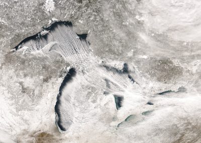
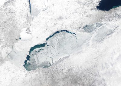
Great Lakes winter satellite image. The winter of 2014 set a new record for ice cover on the Great Lakes with 92 percent of the Lakes frozen over. Photo Credit: NOAA CoastWatch.
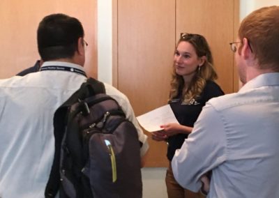
CIGLR Stakeholder Engagement Specialist Devin Gill (left) and Assistant Research Scientist Dr. Ayumi Fujisaki-Manome (right) at the Great Lakes Ice Forecast Needs Assessment Workshop. Photo Credit: Devin Gill.
CIGLR Stakeholder Engagement Specialist Devin Gill (middle) at the Great Lakes Ice Forecast Needs Assessment Workshop. Photo Credit: Devin Gill.
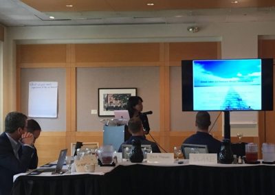
Assistant Research Scientist Dr. Ayumi Fujisaki-Manome at the Great Lakes Ice Forecast Needs Assessment Workshop. Photo Credit: Devin Gill.
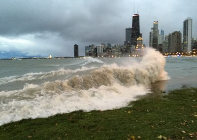
Product of a large storm, high waves were witnessed in Lake Michigan along the Chicago shoreline, October 2014. Photo Credit: L.S. Gerstner.
Satellite image of ice cover on Lake Erie in February 2014. Photo Credit: NOAA Great Lakes CoastWatch.
Video Library
Lake effect snow storms have huge impacts on transportation, public safety and business revenue. Recently, great improvements have been made to forecasting lake effect snow and scientists from CIGLR collaborated on an article that discusses instruments and models that can help improve the accuracy of lake effect snow forecasting.
Video Library
2018 Great Lakes Seminar Series: NOAA ESRL’s Dr. Thomas Hamill presented about improved statistical postprocessing of precipitation for NWS forecasts and hydrologic applications.
Video Library
Great Lakes modeled ice cover from December 8, 2013 through May 9, 2014.


